

- Usage in publication:
-
- Emperor Volcanic Complex*
- Modifications:
-
- Original reference
- Dominant lithology:
-
- Metabasalt
- Metagabbro
- Breccia
- Diabase
- AAPG geologic province:
-
- Lake Superior region
Summary:
See also V.A. Trent, 1973, Geol. map Marenisco and Wakefield NE 7.5-min quadrangles, USGS OF-73-780. Emperor Volcanic Complex. A volcanic rock assemblage composed mainly of: (1) medium dark-gray to medium light-gray basalt flows, 10 to 120 m thick; (2) a flow-breccia unit (Wolf Mountain Creek Formation); and (3) light- to dark-gray and greenish gray metamorphosed intrusive rocks (metagabbro, metadolerite, metadiabase) that include mafic dikes (3 to 180 m thick), phacoliths (120 to 180 m thick), and a thick mafic sill (150 to 300 m thick). Underlies Copps Formation; overlies Palms Formation. The basalt flows intertongue with and overlie lower members of Ironwood Iron-Formation. Age is Precambrian X.
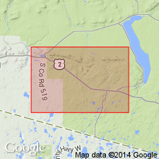
Type locality: exposures north and west of Kimberly Clark logging road, which runs east to north-northeast through secs. 21, 22, and 15, T. 47 N., R. 44 W., Wakefield NE 7.5-min quadrangle, Gogebic Co., [Ottawa National Forest], Northern Peninsula, northwestern MI. Named from Emperor Creek, a tributary of Little Presque Isle River, in secs. 14 and 15, T. 47 N., R. 44 W., Wakefield NE 7.5-min quadrangle, Gogebic Co., Ottawa National Forest, Northern Peninsula, northwestern MI.
Reference section: along the "mine road," in secs. 28, 29, 20, and 21, T. 47 N., R. 43 W., Marenisco Twp., Marenisco 7.5-min quadrangle, Gogebic Co., [Ottawa National Forest], Northern Peninsula, northwestern MI.
Source: Publication.
- Usage in publication:
-
- Emperor Volcanic Complex*
- Modifications:
-
- Revised
- AAPG geologic province:
-
- Lake Superior region
- Wisconsin arch
Summary:
[Not synopsized to date.]
Pg. 5 (fig. 2), 7 (fig. 3), 9-11, geol. map. Emperor Volcanic Complex in Menominee Group of Marquette Range Supergroup.
Source: NA
For more information, please contact Nancy Stamm, Geologic Names Committee Secretary.
Asterisk (*) indicates published by U.S. Geological Survey authors.
"No current usage" (†) implies that a name has been abandoned or has fallen into disuse. Former usage and, if known, replacement name given in parentheses ( ).
Slash (/) indicates name conflicts with nomenclatural guidelines (CSN, 1933; ACSN, 1961, 1970; NACSN, 1983, 2005, 2021). May be explained within brackets ([ ]).