

- Usage in publication:
-
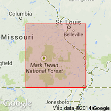
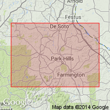
- Elvins formation
- Modifications:
-
- Principal reference
- Dominant lithology:
-
- Shale
- Limestone
- Dolomite
- Conglomerate
- AAPG geologic province:
-
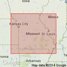
- Ozark uplift
Summary:
Pg. 12, 17, 23-26; USGS Bull. 260-F, p. 234. Elvins formation. Shales, shaly limestones, and more or less earthy dolomites, 0 to 120 feet thick, intervening between shaly top of underlying Bonneterre limestone and cherty limestones of Potosi group above. In vicinity of Elvins and Flat Rock base of Elvins is marked by zone, 6 to 10 feet thick, consisting mainly of indurated platy shale, at bottom and top of which is a layer, a few inches thick, largely made up of lenticular pebbles, usually arranged edgewise, in a subcrystalline limy matrix, and between the layers one or more smaller lenses of conglomerate. This "conglomerate zone" was included in the Potosi by Nason, which writers believe to have been a mistake, and prefer to make it the lower and greater part of a distinct formation for which the name Elvins formation is proposed. The Elvins is = basal part of Potosi limestone and = Potosi slates and conglomerates of Nason. It rests unconformably on Bonneterre limestone, the most appropriate and probably the only strictly available designation for the limestone beneath the conglomerate of Elvins formation. Contact with overlying Potosi [restricted] is at least locally unconformable. In northern part of St. Francois County drillholes frequently pass through 160 to 250 feet of shales and chertless limestone, thus indicating a greater thickness for the formation than is found in section measured at Elvins. However, it is at present not possible to say how much of these shaly beds underlies the conglomerate layers and thus belong to Bonneterre formation.
[Named from exposures at Elvins, St. Francois Co., southeastern MO.]
Source: US geologic names lexicon (USGS Bull. 896, p. 681-682).

- Usage in publication:
-
- Elvins formation
- Modifications:
-
- Not used
- AAPG geologic province:
-
- Ozark uplift
Summary:
Pg. 231 [unable to locate E.R. Buckley, 1907, Missouri Bur. Geol. and Mines, v. 10, 2nd ser., separate, cited in US geologic names lexicon, USGS Bull. 896, p. 682]. In a table, divided Elvins formation into (descending) Doe Run, Derby, and Davis, but did not define the subdivisions.
Source: Publication; US geologic names lexicon (USGS Bull. 896, p. 681-682).
- Usage in publication:
-
- Elvins formation
- Modifications:
-
- Not used
- AAPG geologic province:
-
- Ozark uplift
Summary:
Divided Elvins formation of Ulrich into (descending) Doe Run, Derby, and Davis formations, and restricted Potosi formation to overlying 300 feet of siliceous cherty and drusy dolomite.
Source: US geologic names lexicon (USGS Bull. 896, p. 681-682).

- Usage in publication:
-
- Elvins formation
- Modifications:
-
- Areal extent
- AAPG geologic province:
-
- Ozark uplift
Summary:
Pg. 623, 629. Bonneterre dolomite is followed, apparently without break, by Elvins formation, which begins with a shale and ends with an earthy magnesian limestone. There is an important unconformity between Elvins formation and overlying Potosi dolomite. [Age is Late Cambrian.]
Source: US geologic names lexicon (USGS Bull. 896, p. 681-682).

- Usage in publication:
-
- Elvins group*
- Modifications:
-
- Revised
- AAPG geologic province:
-
- Ozark uplift
Summary:
See also under Bonneterre dolomite and Davis formation. This name is now [ca. 1936] used as a group name, to include Doe Run dolomite, Derby dolomite, and Davis formation. Age is Late Cambrian. [See entry under Josiah Bridge, 1937, USGS Prof. Paper 186-L.]
Named from exposures at Elvins, St. Francois Co., southeastern MO.
Source: US geologic names lexicon (USGS Bull. 896, p. 681-682).
- Usage in publication:
-
- Elvins group*
- Modifications:
-
- Revised
- AAPG geologic province:
-
- Ozark uplift
Summary:
Pg. 234 (table 1). Elvins group. Rank raised to group. Includes (ascending) Davis formation, Derby dolomite, and Doe Run dolomite. Underlies Potosi dolomite; overlies Bonneterre dolomite. [Age is Late Cambrian.]
Source: US geologic names lexicon (USGS Bull. 1200, p. 1251).

- Usage in publication:
-
- Elvins group
- Elvins formation
- Modifications:
-
- Not used
- AAPG geologic province:
-
- Ozark uplift
Branson, E.B., 1944, The geology of Missouri: University of Missouri Studies, v. 19, no. 3, 535 p.
Summary:
Pg. 30. Term Elvins as introduced by Ulrich is not recognized as valid in this report. As a group it would include the Davis and Derby and probably part of the Potosi.
Source: US geologic names lexicon (USGS Bull. 1200, p. 1251).
- Usage in publication:
-
- Elvins formation
- Modifications:
-
- Biostratigraphic dating
- Areal extent
- AAPG geologic province:
-
- Ozark uplift
Kurtz, V.E., 1960, Stratigraphy and paleontology of the Elvins formation, southeast Missouri: Dissertation Abstracts, v. 21, no. 3, p. 595., Norman, OK, Univ. Oklahoma PhD dissert., 196 p., 1960
Summary:
Referred to as Elvins formation comprising (ascending) Davis, Derby, and Doerun members. Separated from underlying Bonneterre dolomite by disconformity; shows facies relationships with underlying Potosi formation. Contains four faunal zones. Age is Late Cambrian.
Source: US geologic names lexicon (USGS Bull. 1200, p. 1251).

- Usage in publication:
-
- Elvins group
- Modifications:
-
- Overview
- AAPG geologic province:
-
- Ozark uplift
Summary:
(Paleozoic Era; Cambrian System by W.C. Hayes and R.D. Knight, p. 16-17 (fig. 3), 18-19.) Elvins group. Comprises (descending) Derby-Doerun formation and Davis formation. Lower part is shaly, to south is dolomitic. Upper part is fine-grained, thin- to medium-bedded, shaly dolomite. Lies above Bonneterre formation and below Potosi formation. Age is Late Cambrian.
Source: Publication.
- Usage in publication:
-
- Elvins Group
- Modifications:
-
- Overview
- AAPG geologic province:
-
- Ozark uplift
Summary:
Pg. 94-95. Elvins Group. Comprises (descending) Davis Formation and Derby-Doerun Dolomite. Underlies Potosi Dolomite and overlies Bonneterre Formation. This was also called "Fredericktown" (in part) and "Potosi slates and conglomerates." Age is Late Cambrian.
Source: Publication.
- Usage in publication:
-
- Elvins Group
- Modifications:
-
- Principal reference
- Reference
- AAPG geologic province:
-
- Ozark uplift
Thompson, T.L., Mulvany, P.S., Palmer, J.R., Davis, J.G., and Miller, J.F., 2013, Cambrian stratigraphic succession in Missouri; Chapter 3: Missouri Geological Survey Report of Investigations, no. 70, pt. 1 (revised), p. 25-266.
Summary:
Pg. 128-176. Elvins Group.
Principal reference section: deep and benched roadcuts along new MO Route 8 for a distance of about 5 mi btw. town of Gumbo
Regional reference section (measured sections of Kurtz, 1960, p. 147-153): (1) along Hayden Creek, west of Leadwood, proceeding in a southerly direction up a dry tributary valley immediately northwest of the small town of Frankclay, in SW/4 NW/4 and NW/4 SW/4 sec. 5, T. 36 N., R. 4 E., Flat River 7.5-min quadrangle; (2) east of Leadwood, extending from NE/4 SE/4 sec. 3 to NW/4 NW/4 NW/4 sec. 2, T. 36 N., R. 4 E., Flat River 7.5-min quadrangle, St. Francois Co., southeastern MO.
Source: Publication.
For more information, please contact Nancy Stamm, Geologic Names Committee Secretary.
Asterisk (*) indicates published by U.S. Geological Survey authors.
"No current usage" (†) implies that a name has been abandoned or has fallen into disuse. Former usage and, if known, replacement name given in parentheses ( ).
Slash (/) indicates name conflicts with nomenclatural guidelines (CSN, 1933; ACSN, 1961, 1970; NACSN, 1983, 2005, 2021). May be explained within brackets ([ ]).