

- Usage in publication:
-
- Elves Chasm member
- Modifications:
-
- Original reference
- Dominant lithology:
-
- Dolomite
- AAPG geologic province:
-
- Plateau sedimentary province
Summary:
"It is confusing, from McKee's text and fig. 1 whether the tongue is assigned to the Muav formation or to the Bright Angel shale" (GNC note, n.d.). Elves Chasm tongue [of Muav formation of Tonto group] (USGS Bull. 1200); Elves Chasm tongue [of Bright Angel shale of Tonto group] (USGS DDS-6).
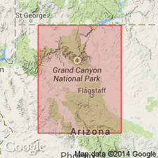
Pg. 14 (fig. 1), 29, 87-88. Lower of two prominent rusty-brown dolomite cliffs in Elves Chasm Canyon, Coconino County, northwestern Arizona. Noble (1922, USGS Prof. Paper 131-B) described it as a snuff-brown massive crystalline dolomite which passes down into beds of buff fine-grained cross-bedded glauconitic sandstone in vicinity of Bass trail. Thickness at Bass Canyon 12 feet; at Fossil Rapids 35 feet; and at Gateway Canyon 50 feet. Older than Garnet Canyon tongue (new); younger than Meriwitica tongue (new). Fossils: trilobite (KOOTENIA), gastropod (HYOLITHES), sponge or archaeocyathid. [On p. 29 age stated to be Early and Middle Cambrian and on p. 184 (part 2) Middle Cambrian. Age is considered Early and(or) Middle Cambrian.] Report includes cross sections, measured sections.
Type locality not designated. Is an excellent horizon marker throughout most of east-central Grand Canyon. Can be traced eastward from Bass Canyon to and beyond Hermit Canyon. Named from Elves Chasm Canyon, Grand Canyon, Coconino Co., northwestern AZ.
Source: US geologic names lexicon (USGS Bull. 1200, p. 1251); supplemental information from GNU records (USGS DDS-6; Menlo GNULEX, Denver GNULEX), GNC index card files.
For more information, please contact Nancy Stamm, Geologic Names Committee Secretary.
Asterisk (*) indicates published by U.S. Geological Survey authors.
"No current usage" (†) implies that a name has been abandoned or has fallen into disuse. Former usage and, if known, replacement name given in parentheses ( ).
Slash (/) indicates name conflicts with nomenclatural guidelines (CSN, 1933; ACSN, 1961, 1970; NACSN, 1983, 2005, 2021). May be explained within brackets ([ ]).