- Usage in publication:
-
- Elmwood beds
- Modifications:
-
- Named
- Dominant lithology:
-
- Limestone
- AAPG geologic province:
-
- Appalachian basin
Summary:
Pg. 26, 27-31. Elmwood beds. Underlies, with sharp contact, Clark Reservation limestone and grades into underlying Olney limestone, all included in Manlius group. Is divided into (descending): (1) Elmwood C, upper water lime, consisting of 4+/- feet of drab water lime usually very soft, barren in Onondaga County; (2) Elmwood B, bluish black limestone, which disappears to west; (3) Elmwood C, lower water lime, consisting of 6+/- feet of drab water lime nearly or quite barren, sometimes hard in lower part, but chiefly fairly soft. Age is Silurian [see 1935 entry under Manlius Limestone].
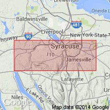
Type section: at Sweet's quarry, about 0.5 mi northeast of Onondaga Hill and in belt between St. Agnes Cemetery and Elmwood Park, Onondaga Co., central NY.
Source: US geologic names lexicons (USGS Bull. 896, p. 679-680; USGS Bull. 1200, p. 2356-2357).
For more information, please contact Nancy Stamm, Geologic Names Committee Secretary.
Asterisk (*) indicates published by U.S. Geological Survey authors.
"No current usage" (†) implies that a name has been abandoned or has fallen into disuse. Former usage and, if known, replacement name given in parentheses ( ).
Slash (/) indicates name conflicts with nomenclatural guidelines (CSN, 1933; ACSN, 1961, 1970; NACSN, 1983, 2005, 2021). May be explained within brackets ([ ]).

