

- Usage in publication:
-
- Elmdale formation
- Modifications:
-
- Original reference
- Dominant lithology:
-
- Shale
- Limestone
- AAPG geologic province:
-
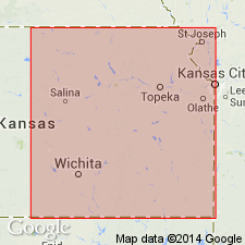
- Nemaha anticline
Summary:
Pg. 178. Elmdale formation proposed in unpublished mss. by C.S. Prosser and J.W. Beede. Consists of shales with occational thin limestones; 111 to 118 feet thick; containing many fossils in lower part. Underlies Neva limestone and overlies limestone which is probably = Americus limestone. [Age is Pennsylvanian].
Named from exposures east of Elmdale, Chase Co., eastern KS.
Source: US geologic names lexicon (USGS Bull. 896, p. 678-679).
- Usage in publication:
-
- Elmdale formation
- Modifications:
-
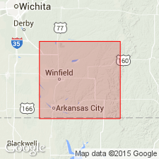
- Areal extent
- AAPG geologic province:
-
- Nemaha anticline
Summary:
Pg. 708. Elmdale formation. Yellowish to bluish shales, with thin beds of alternating limestone including 2 or 3 thicker ones. Thickness 130 feet. Underlies Neva limestone and overlies Americus limestone. [Age is Pennsylvanian.]
Well exposed on bluff east of the town of Elmdale, Chase Co., eastern KS.
Source: US geologic names lexicon (USGS Bull. 896, p. 678-679); supplemental information from GNU records (USGS DDS-6; Denver GNULEX).
- Usage in publication:
-
- Elmdale formation
- Modifications:
-
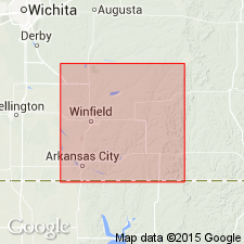
- Areal extent
- AAPG geologic province:
-
- Nemaha anticline
Summary:
Elmdale formation. Shales with some thin interbedded limestones. Thickness about 130 feet. Overlies Americus limestone and underlies Neva limestone. Fossiliferous. Age is late Carboniferous [Pennsylvanian]. Mapped in Cottonwood Falls quadrangle.
Source: Modified from GNU records (USGS DDS-6; Denver GNULEX).
- Usage in publication:
-
- Elmdale formation
- Modifications:
-
- Overview
- AAPG geologic province:
-
- Nemaha anticline
- Forest City basin
Summary:
Pg. 150-154. Elmdale formation. Underlies Neva limestone and overlies Americus limestone. [This definition of Elmdale was followed for many years.]
Source: US geologic names lexicon (USGS Bull. 896, p. 678-679).
- Usage in publication:
-
- Elmdale beds
- Modifications:
-
- Revised
- AAPG geologic province:
-
- Nemaha anticline
- Forest City basin
Summary:
Elmdale beds, 150 feet thick, overlie Americus limestone and shales and underlie Crusher Hill alternating shales and limestones. They include a friable FUSULINA limestone 24 feet above base; the Neva and Cottonwood limestones and intervening beds; and at top, 12 feet of shale. [Age is Pennsylvanian.]
Source: US geologic names lexicon (USGS Bull. 896, p. 678-679).

- Usage in publication:
-
- Elmdale shale member
- Modifications:
-
- Revised
- AAPG geologic province:
-
- Forest City basin
Summary:
Elmdale shale member of Wabaunsee formation. Includes (ascending) Stine shale, Houchin Creek limestone, Hughes Creek shale, Long Creek limestone, Johnson shale, Glenrock limestone, Bennett shale, Howe limestone, and Roca shale beds. Thickness 120 feet. Overlies Americus limestone member and underlies Neva limestone member; all included in Wabaunsee formation. Age is Late Pennsylvanian (Missourian). Report includes cross sections, measured sections, geologic maps, stratigraphic tables.
Source: GNC KS-NE Pennsylvanian Corr. Chart, sheet 1, Oct. 1936; supplemental information from GNU records (USGS DDS-6; Denver GNULEX).
- Usage in publication:
-
- Elmdale shale*
- Modifications:
-
- Revised
- AAPG geologic province:
-
- Nemaha anticline
Summary:
Pg. 38, 52. Elmdale shale. As defined by Prosser and subsequently used in Kansas, the Elmdale shale included a series of beds of shale and limestone above Americus limestone and below Neva limestone, with a total thickness of 130 feet. The strata between same limiting beds are but little less than 130 feet thick in Cowley County, eastern Kansas, but lower third of this thickness combined with Americus(?) limestone is herein called Foraker limestone, thus restricting Elmdale shale to strata between Foraker and Neva limestones, having a total thickness of about 80 feet. The lowermost third of Elmdale formation as thus defined is mostly shale and is succeeded by 20 feet of thin-bedded gray limestone, of which the uppermost 2 or 3 feet is deep buff and soft, the whole 20 feet constituting the Red Eagle limestone member. Age is Pennsylvanian.
Source: US geologic names lexicon (USGS Bull. 896, p. 678-679).
- Usage in publication:
-
- Elmdale shale*
- Modifications:
-
- Areal extent
- AAPG geologic province:
-
- Nemaha anticline
- Forest City basin
Summary:
Pg. 50, footnote. Elmdale shale. The section east of Elmdale exhibits clearly all subdivisions of Elmdale shale differentiated and named by Condra in Nebraska (Nebraska Geol. Survey Bull., no. 1, 2nd ser., p. 84, 1927), with Americus limestone at base and Neva limestone at top. The Foraker probably includes equivalents of Americus limestone, Stine shale, Houchens Creek limestone, Hughes Creek shale, and Long Creek limestone. In view of known remarkable lateral persistence of minor stratigraphic units from Nebraska to central Kansas, it is likely detailed stratigraphic work will afford basis for definite determination of relations of type Foraker to Americus and Elmdale. Age is Pennsylvanian.
[See 1932 entry under Admire shale, for later definitions of boundaries.]
Source: US geologic names lexicon (USGS Bull. 896, p. 678-679).

- Usage in publication:
-
- Elmdale shale†
- Modifications:
-
- Abandoned
- AAPG geologic province:
-
- Nemaha anticline
- Forest City basin
Summary:
Pg. 50 and 251. Dropped Elmdale shale from his revised classification, treating its many subdivisions as formations. (See "Modern classifications of the Pennsylvanian rocks of eastern Kansas and southeastern Nebraska," compiled by M.G. Wilmarth, Secretary of Committee on Geologic Names, USGS unpub. corr. chart, Oct. 1936, sheet 2.) The USGS has not yet [ca. 1938] had occasion to consider these innovations for its publications.
Source: US geologic names lexicon (USGS Bull. 896, p. 678-679); GNC KS-NE Pennsylvanian Corr. Chart, sheet 2, Oct. 1936.

- Usage in publication:
-
- Elmdale shale*
- Elmdale formation*
- Modifications:
-
- Overview
- AAPG geologic province:
-
- Nemaha anticline
- Forest City basin
Summary:
USGS classification (ca. 1938): Elmdale shale of Wabaunsee group (Kansas); Elmdale formation of Wabaunsee group (Oklahoma). Present in eastern Kansas, southeastern Nebraska, and central northern and central Oklahoma. Age is Pennsylvanian.
Source: US geologic names lexicon (USGS Bull. 896, p. 678-679).

- Usage in publication:
-
- Elmdale shale†
- Elmdale formation†
- Modifications:
-
- Abandoned
- AAPG geologic province:
-
- Nemaha anticline
- Forest City basin
Summary:
The USGS has abandoned terms †Elmdale shale and †Elmdale formation.
Source: US geologic names lexicon (USGS Bull. 896, p. 678-679).
For more information, please contact Nancy Stamm, Geologic Names Committee Secretary.
Asterisk (*) indicates published by U.S. Geological Survey authors.
"No current usage" (†) implies that a name has been abandoned or has fallen into disuse. Former usage and, if known, replacement name given in parentheses ( ).
Slash (/) indicates name conflicts with nomenclatural guidelines (CSN, 1933; ACSN, 1961, 1970; NACSN, 1983, 2005, 2021). May be explained within brackets ([ ]).