The National Geologic Map Database is migrating to a new infrastructure. We apologize for any service disruptions during this process.
|
|---|


- Usage in publication:
-
- "Elm Creek" limestone
- Modifications:
-
- Original reference
- Dominant lithology:
-
- Limestone
- AAPG geologic province:
-
- Chautauqua platform
Summary:
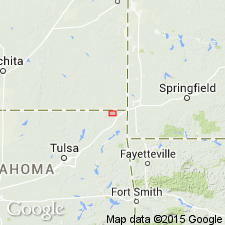
Pg. 25-26. "Elm Creek" limestone. A 6- to 10-inch band of limestone, containing abundant fossils, is present in several places within Cherokee formation in northwestern part of Ottawa County, northeastern Oklahoma, and adjoining area in Kansas. It occurs along Elm Creek, south of the road, in NW/4 SE/4 sec. 10, T. 29 N., R. 22 E.; along Fourmile Creek in central part of sec. 15, T. 29 N., R. 21 E. Also on south slope of a hill in western part of sec. 15, T. 35 S., R. 3 E. (Kansas), a short distance north of Kansas State line. Exact horizon of the limestone could not be definitely determined, but where developed it probably occurs 10 to 20 feet below Bluejacket sandstone; but it was not found in sections where the Bluejacket is known to occur. It is such a thin bed that it may not have been developed except in a few places, and it is possible the above occurrences do not represent same horizons.
Source: US geologic names lexicon (USGS Bull. 896, p. 678).
- Usage in publication:
-
- Elm Creek limestone†
- Modifications:
-
- Abandoned
- AAPG geologic province:
-
- Chautauqua platform
Summary:
Pg. 107. †Elm Creek limestone. Abandoned by Oklahoma Geological Survey. Name preoccupied. Weidman's name has not been replaced.
[Rocks reallocated to Desmoinesian McCurtain Shale Member of McAlester Formation of Cherokee Group, according to R.O. Fay, Oklahoma Geol. Survey Open-File Report 2-97, p. 65.]
Source: US geologic names lexicon (USGS Bull. 1200, p. 1244).
For more information, please contact Nancy Stamm, Geologic Names Committee Secretary.
Asterisk (*) indicates published by U.S. Geological Survey authors.
"No current usage" (†) implies that a name has been abandoned or has fallen into disuse. Former usage and, if known, replacement name given in parentheses ( ).
Slash (/) indicates name conflicts with nomenclatural guidelines (CSN, 1933; ACSN, 1961, 1970; NACSN, 1983, 2005, 2021). May be explained within brackets ([ ]).