The National Geologic Map Database is migrating to a new infrastructure. We apologize for any service disruptions during this process.
|
|---|


- Usage in publication:
-
- /Ellsworth Formation
- Modifications:
-
- Revised
- AAPG geologic province:
-
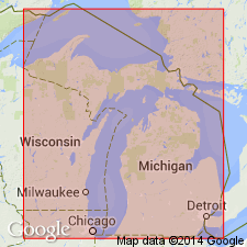
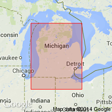
- Michigan basin
Summary:
Previously defined Antrim Shale is here raised in rank to Antrim Group and divided into three formations (ascending): Antrim (revised), Ellsworth (revised) , and Sanilac (new) Formations. The Sanilac consists of black shales formerly included within the upper part of the Ellsworth Shale in western MI and upper black shales within the Antrim Shale of eastern MI. Ellsworth Formation (revised) consists of gray shales below the upper black shales of the former Ellsworth in western MI and the gray shales of the "Upper" or "Light" Antrim of eastern MI. The Antrim Formation [of this report] is composed of black and gray shales below the Ellsworth and includes the previously known Traverse Formation. Antrim Formation is subdivided into (ascending) Mud Lake Gray Shale Member (Traverse Formation), Charlton Black Shale Member (lower black shale), Crapo Creek Gray Shale Member (middle gray shale), and Chester Black Shale Member (upper black shale). [Usage of the Antrim in this proposal is in violation of the NACSN, 1983, Art. 19(g), and is not recommended.]
Source: GNU records (USGS DDS-6; Reston GNULEX).

- Usage in publication:
-
- Ellsworth Shale*
- Modifications:
-
- Age modified
- Dominant lithology:
-
- Shale
- AAPG geologic province:
-
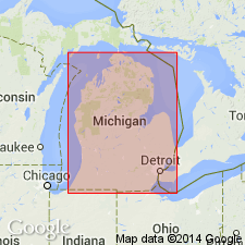
- Michigan basin
Summary:
Age of Ellsworth Shale changed from Late Devonian and Early Mississippian to Late Devonian only. Base of the Ellsworth is the change from black Antrim Shale to greenish-gray shale; the top is an unconformity overlain by Mississippian Sunbury Shale or Coldwater Shale. The Ellsworth is a western facies of all but the lowest part of the Antrim in the Michigan basin with an intertonguing relationship.
Source: GNU records (USGS DDS-6; Reston GNULEX).
- Usage in publication:
-
- Ellsworth Shale
- Modifications:
-
- Areal extent
- Overview
- AAPG geologic province:
-
- Michigan basin
Summary:
Ellsworth Shale, exposed only in Antrim and Charlevoix Cos, is restricted to the western part of the Michigan basin where it replaces Antrim and Sunbury Shales. Averages about 152 m thick in the westernmost parts of the basin, but elsewhere it is typically 91 to 152 m thick. On the basis of conodonts, lithology, and stratigraphic position, the Ellsworth, Antrim, and Sunbury Shales of MI are considered equivalent in age to the New Albany of IN, IL, and KY. The Ellsworth is predominantly a silty shale of gray, greenish gray or more commonly green color. Siltstone and sandstone are minor components and are most abundant in the westernmost and southwestern parts of the basin. Oolitic limestone and dolostone beds are present in the upper portion or the formation. The true Berea of eastern Michigan is laterally separated from the Ellsworth Shale by the Antrim Shale in the central part of the basin.
Source: GNU records (USGS DDS-6; Reston GNULEX).
- Usage in publication:
-
- Ellsworth Member
- Modifications:
-
- Overview
- AAPG geologic province:
-
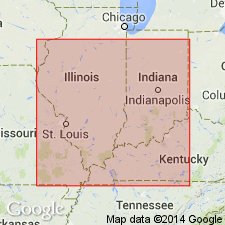
- Illinois basin
Summary:
In the Illinois basin, the Ellsworth is a member of the New Albany Shale. Gray shale is the dominant lithology, but unit includes brownish-black and greenish- to medium-gray shale. The Henryville and Jacobs Chapel Beds are included in the Ellsworth in central IN. The Falling Run Bed is not present in this area. Unit ranges in thickness from 7 ft in Bartholomew Co. to about 21 ft in Morgan Co. Thickens to more than 40 ft in southwestern IN and is more than 80 ft thick in northwestern Benton Co. where it grades into the upper part of the underlying Clegg Creek Member. The Ellsworth Member of IN is equivalent to the Saverton Shale, the Louisiana Limestone, the Horton Creek Formation, and the Hannibal Shale of IL and to the undifferentiated Saverton and Hannibal Shales of western KY. Age is Late Devonian and Early Mississippian.
Source: GNU records (USGS DDS-6; Reston GNULEX).
- Usage in publication:
-
- Ellsworth, upper Antrim
- Modifications:
-
- Revised
- AAPG geologic province:
-
- Michigan basin
Summary:
Author feels existing formational names defined by lithology and color are inadequate to describe a framework based on gamma-ray log correlations. New informal terminology is introduced to recognize the facies relation between the western Ellsworth Shale and the upper part of the eastern Antrim Shale. The new unit is called the "Ellsworth/upper Antrim" and conforms to Forgotson's definition of a "format." In addition, the term "lower Antrim" is introduced for the western Antrim and the lower part of the eastern Antrim. It is continuous throughout the entire basin. Contact between the lower Antrim and the Ellsworth/upper Antrim is at the position of the time-stratigraphic marker FOERSTIA (PROTOSALVINIA).
Source: GNU records (USGS DDS-6; Reston GNULEX).
For more information, please contact Nancy Stamm, Geologic Names Committee Secretary.
Asterisk (*) indicates published by U.S. Geological Survey authors.
"No current usage" (†) implies that a name has been abandoned or has fallen into disuse. Former usage and, if known, replacement name given in parentheses ( ).
Slash (/) indicates name conflicts with nomenclatural guidelines (CSN, 1933; ACSN, 1961, 1970; NACSN, 1983, 2005, 2021). May be explained within brackets ([ ]).