

- Usage in publication:
-
- Ella Dolomite*
- Modifications:
-
- First used
- Dominant lithology:
-
- Dolomite
- Quartzite
- AAPG geologic province:
-
- Idaho Mountains province
Summary:
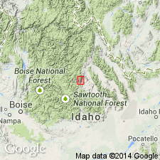
First published use of name defined by Patton (1948) in an unpublished thesis. Was formerly (Ross, 1934) mapped as part of Kinnikinic Quartzite, a term redefined in this report. Named for exposures near Ella mine and Clayton, Custer Co, ID in Idaho Mountains province. Is a sequence of medium- to thick-bedded gray dolomite usually in thin laminae, predominately fine gained, but some portions medium to coarsely crystalline. Some layers are quartzite; some are sandy dolomite; some algal structures. Is at least 700 ft thick. Overlies Clayton Mine Quartzite (a new name) and underlies restricted Kinnikinic Quartzite. Is fossiliferous (brachiopods and conodonts). Assigned Middle Ordovician age.
Source: GNU records (USGS DDS-6; Denver GNULEX).
- Usage in publication:
-
- Ella Marble*
- Modifications:
-
- Overview
- Redescribed
- Dominant lithology:
-
- Marble
- AAPG geologic province:
-
- Idaho Mountains province
- Snake River basin
Summary:
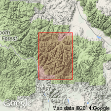
Mapped in central part of map area east and north of Pioneer thrust fault system within "Pioneer window." Study area is within Blaine and Custer Cos, ID, in Idaho Mountains province and Snake River basin. Thickness is about 200 m. Redescribed as buff-weathering calc-silicate marble. Upper part contains light-gray to buff, thin- to medium-bedded marble with variable content of calcite, quartz, and calcsilicate minerals; lower part is buff, massive, more uniform and more coarsely crystalline diopside marble that characteristically crumbles to coarse calcite-diopside sand. Discontinuous 3-6 m-thick zone of siliceous rocks, including quartzite, separates upper and lower parts locally. Unconformably? overlies Clayton Mine Quartzite with sharp and fairly concordant contact; conformably underlies Kinnikinic Quartzite. Assigned Middle Ordovician age.
Source: GNU records (USGS DDS-6; Denver GNULEX).
- Usage in publication:
-
- Ella Dolostone*
- Modifications:
-
- Redescribed
- Dominant lithology:
-
- Dolostone
- AAPG geologic province:
-
- Snake River basin
Summary:
Is redescribed as dolostone. The name "dolostone" is used for rocks composed predominantly of the mineral "dolomite" on Figure 2 and throughout this chapter, although in the literature it has been common practice to use dolomite rather than dolostone in formal names of dolomitic formations and members. Occurs in stratigraphic column for central ID (Snake River basin). Unconformably above Cash Creek Quartzite (Lower Cambrian); conformably below Kinnikinic Quartzite (Middle Ordovician). Assigned to Whiterockian Series (Middle Ordovician).
Uses Blacksmith Dolostone. In fig. 2 and throughout chapter, "dolostone" is used for rocks composed predominantly of the mineral "dolomite." [Although "dolostone" is the proper term, it has not often been applied to dolomitic formations and members; historically, common practice in the literature has been the use of "dolomite."] Blacksmith Dolostone shown in stratigraphic column of north-central Utah (Great Basin province). Overlies Ute Limestone (Middle Cambrian); underlies Bloomington Formation (Middle Cambrian). Age is Middle Cambrian.
Source: GNU records (USGS DDS-6; Denver GNULEX).
For more information, please contact Nancy Stamm, Geologic Names Committee Secretary.
Asterisk (*) indicates published by U.S. Geological Survey authors.
"No current usage" (†) implies that a name has been abandoned or has fallen into disuse. Former usage and, if known, replacement name given in parentheses ( ).
Slash (/) indicates name conflicts with nomenclatural guidelines (CSN, 1933; ACSN, 1961, 1970; NACSN, 1983, 2005, 2021). May be explained within brackets ([ ]).