

- Usage in publication:
-
- Elkhead Limestone*
- Modifications:
-
- Named
- Dominant lithology:
-
- Limestone
- AAPG geologic province:
-
- Snake River basin
Summary:
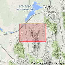
Named for Elkhead Ranch on Midnight Creek, Power Co, ID in Snake River basin. Type locality designated in secs 7, 8, 17, and 18, T8S, R34E. Name applied to rocks equivalent to Langston, Ute, and Blacksmith Limestones. Mapped in northern part of Arbon quad. Is wholly limestone except for a gray, thin-bedded, ledge-forming, platy shale about 100 ft thick a few hundred ft above the base. Limestone is gray, thick-bedded to massive, and oolitic. Is about 2,100 ft thick. Overlies Gibson Jack Formation; underlies Bloomington Formation. Trilobites of early Middle Cambrian age found a few hundred ft above base and of Middle Cambrian age as high as 170 ft below top. Geologic map.
Source: GNU records (USGS DDS-6; Denver GNULEX).
For more information, please contact Nancy Stamm, Geologic Names Committee Secretary.
Asterisk (*) indicates published by U.S. Geological Survey authors.
"No current usage" (†) implies that a name has been abandoned or has fallen into disuse. Former usage and, if known, replacement name given in parentheses ( ).
Slash (/) indicates name conflicts with nomenclatural guidelines (CSN, 1933; ACSN, 1961, 1970; NACSN, 1983, 2005, 2021). May be explained within brackets ([ ]).