

- Usage in publication:
-
- Elk Ridge limestone*
- Modifications:
-
- Named
- Dominant lithology:
-
- Limestone
- Sandstone
- Conglomerate
- AAPG geologic province:
-
- Eagle basin
Summary:
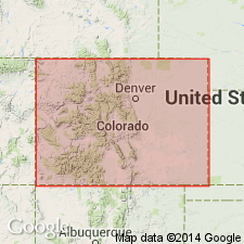
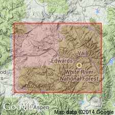
Named as an informal locally used unit in the middle unit of an unnamed sequence of Pennsylvanian age. Consists of two limestone beds separated by 175 to 225 ft of red sandstone and conglomerate. The lower limestone is 12 to 15 ft thick and is divisible into a lower mottled blue-gray unit 6 to 7 ft thick and an upper gray crystalline unit 7 to 8 ft thick. The lowest unit forms the crest of Elk Ridge. The upper limestone is dense, blue gray and 5 to 7 ft thick. Overlies an unnamed cream to gray micaceous sandstone and interbedded black carbonaceous shale of the middle unit of an unnamed sequence of Pennsylvanian age. Underlies an unnamed white to cream micaceous sandstone of the middle unit of an unnamed sequence of Pennsylvanian age. Geologic map. Stratigraphic chart. Report lies in Summit Co, CO in the Eagle basin.
Source: GNU records (USGS DDS-6; Denver GNULEX).
- Usage in publication:
-
- Elk Ridge limestone member*
- Modifications:
-
- Revised
- Dominant lithology:
-
- Limestone
- Dolomite
- AAPG geologic province:
-
- Eagle basin
Summary:
Pg. 152 (table 1), 202-203. Elk Ridge limestone member of Minturn formation. Limestone, which in Pando area [Eagle County, Colorado] lies 275 feet above Robinson member of Minturn formation, or about 4,800 feet above Belden shale, is known as Elk Ridge limestone [miners' term] at Kokomo and is here designated Elk Ridge limestone member of Minturn formation. In Pando area, member is single limestone bed 7.5 feet thick; where thickest, on Radio Ridge, consists of 3 feet of dark, fine-grained, thin-bedded dolomite, overlain by 10 feet of mottled gray and pink slightly sandy locally oolitic limestone. Lies 150 to 200 feet below White Quail limestone member. [Age is Pennsylvanian.]
Source: US geologic names lexicon (USGS Bull. 1200, p. 1237-1238).
For more information, please contact Nancy Stamm, Geologic Names Committee Secretary.
Asterisk (*) indicates published by U.S. Geological Survey authors.
"No current usage" (†) implies that a name has been abandoned or has fallen into disuse. Former usage and, if known, replacement name given in parentheses ( ).
Slash (/) indicates name conflicts with nomenclatural guidelines (CSN, 1933; ACSN, 1961, 1970; NACSN, 1983, 2005, 2021). May be explained within brackets ([ ]).