The National Geologic Map Database is migrating to a new infrastructure. We apologize for any service disruptions during this process.
|
|---|


- Usage in publication:
-
- Elder sandstone*
- Modifications:
-
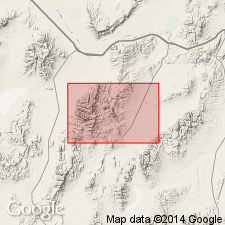
- Areal extent
- Dominant lithology:
-
- Sandstone
- AAPG geologic province:
-
- Great Basin province
Gilluly, James, 1955, [Title unknown]: American Association of Petroleum Geologists, Pacific Petroleum Geology Newsletter, v. 9, no. 8, p. 1.
Summary:
Pg. 1. Elder sandstone. Thickness 3,000 to 5,000 feet. Arkosic sandstone dominant with beds of tan, pale, or buff chert. Overlies Ordovician Valmy formation; underlies Middle Devonian Slaven chert (new). Age not stated.
Occurs in Roberts Mountains area, Eureka district, northeastern NV.
Source: US geologic names lexicon (USGS Bull. 1200, p. 1224).
- Usage in publication:
-
- Elder Sandstone*
- Modifications:
-
- Named
- Biostratigraphic dating
- Mapped
- Dominant lithology:
-
- Sandstone
- Siltstone
- Shale
- Chert
- AAPG geologic province:
-
- Great Basin province
Summary:
Pg. 9 (table 1), 30-31, 35-36, pl. 1 (geol. map), pl. 3 (corr. chart), pl. 4 (fossil locs.). Elder Sandstone. Present in upper plate of Roberts thrust (siliceous western facies). Consists mostly of silty sandstone with subordinate interbeds of siltstone, sandy siliceous tuffite shale, and thin, platy, light-tan, light-gray, and yellow-brown chert; much of sandstone and siltstone is notably feldspathic. Euhedral pyrite is very common; oxidation of the pyrite gives formation its distinctive yellow-brown color. Bounded by faults so original relations to Valmy Formation or Slaven Chert are unknown. Estimated thickness 2,000 to 4,000 feet. Age is considered Early Silurian (Llandovery, probably late Llandovery), based on fossils (graptolites) identified from two small collections. Report includes geologic map, faunal list, correlation chart.
Type locality: hill extending northeastward from sharp bend of Elder Creek, in sec. 30, T. 28 N., R. 46 E., Lander Co., NV, to Utah Mine, in sec. 16 (unsurveyed), T. 28 N., R. 46 E., Eureka Co., NV. Named from exposures in drainage basin of Elder Creek, in southeastern part of Mount Lewis quadrangle, Lander Co., northern NV.
Source: Publication.
For more information, please contact Nancy Stamm, Geologic Names Committee Secretary.
Asterisk (*) indicates published by U.S. Geological Survey authors.
"No current usage" (†) implies that a name has been abandoned or has fallen into disuse. Former usage and, if known, replacement name given in parentheses ( ).
Slash (/) indicates name conflicts with nomenclatural guidelines (CSN, 1933; ACSN, 1961, 1970; NACSN, 1983, 2005, 2021). May be explained within brackets ([ ]).