

- Usage in publication:
-
- El Rito formation
- Modifications:
-
- First used
- Dominant lithology:
-
- Sandstone
- Conglomerate
- Breccia
- AAPG geologic province:
-
- San Juan basin
Summary:
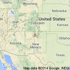
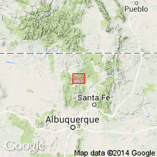
First description and use of name. Type localities found along Arroyo Hondo about 4 mi south of Santa Fe and along Little Tesuque Canyon, nearly 5 mi northeast of Santa Fe, Abiquiu quad, Rio Arriba Co, NM, San Juan basin. Limited to a narrow belt: is in Ortega Mountains, along both branches of El Rito Creek; in badland area west of Cerro de las Minas; on north bank of the Chama, about 5 mi west of Abiquiu; and in vicinity of Canones. Composed of sandstone, conglomerate, and breccia, all having characteristic brick-red color. Rock is well consolidated; stands in steep cliffs. Pebbles dominantly of quartzite; volcanic material absent. Maximum thickness about 200 ft. In northeast part of quad, occurs as a fill deposited in narrow valleys eroded in quartzite. Outward from valleys, rock grades from heterogeneous breccia to a poorly sorted conglomerate without distinct bedding. Breccia represents an indurated regolith and talus; conglomerate, a torrential stream deposit. Well cemented; matrix compact, fine grained with brick-red color; color also found as stain along joint planes in pre-Cambrian to depths of tens of ft beneath base of breccia and conglomerate. Southwest, unit contains much more sandstone; color lighter. Overlies with angular unconformity beds of Morrison formation; overlain with erosional unconformity Abiquiu tuff (new). Age uncertain; position beneath Abiquiu suggests at least pre-late Miocene, and may be old as Eocene.
Source: GNU records (USGS DDS-6; Denver GNULEX).
- Usage in publication:
-
- El Rito formation
- Modifications:
-
- Areal extent
- AAPG geologic province:
-
- San Juan basin
Summary:
El Rito formation is composed of reddish shale, arkose, and tuff in Cerro Pedernal of Abiquiu quad, Rio Arriba Co, Jemez Mountains, NM, San Juan basin. Overlies unconformably the Cretaceous Dakota sandstone. Underlies Abiquiu tuff. Age is late Eocene, Oligocene, or early Miocene, but more probably late Eocene or Oligocene. It is not found west of Cerro Pedernal, and probably pinches out under the Valle de la Grulla.
Source: GNU records (USGS DDS-6; Denver GNULEX).
- Usage in publication:
-
- El Rito formation
- Modifications:
-
- Revised
- Areal extent
- AAPG geologic province:
-
- San Juan basin
Summary:
El Rito formation revised--upper contact changed. Overlain by Abiquiu tuff member, which is assigned in this report to Santa Fe formation (revised) [presumably as basal unit of Santa Fe, although not explicitly stated] in report area--Chama basin, Rio Arriba Co, NM. Abiquiu tuff member outcrops in southeast corner of Canjilon SE quad, Rio Arriba Co, where it unconformably overlies El Rito formation and underlies rest of Santa Fe formation with gradational contact. El Rito overlies older formations (Cutler, Agua Zarca, Chinle, Entrada, and Mancos shale) with an angular unconformity. Areally extends El Rito as mapped by Smith (1938) in Abiquiu quad--outcrops in the southeast corner of Magote Peak quad, and the east half of the Canjilon SE quad. A number of outcrops are also present near crest of Magote Ridge [this ridge is referred to as Canjilon Divide by Smith (1936), but is named Magote Ridge on the Magote Peak quad map, published in 1953]. Age of El Rito uncertain; likely it is early Tertiary, possibly Eocene.
Source: GNU records (USGS DDS-6; Denver GNULEX).
For more information, please contact Nancy Stamm, Geologic Names Committee Secretary.
Asterisk (*) indicates published by U.S. Geological Survey authors.
"No current usage" (†) implies that a name has been abandoned or has fallen into disuse. Former usage and, if known, replacement name given in parentheses ( ).
Slash (/) indicates name conflicts with nomenclatural guidelines (CSN, 1933; ACSN, 1961, 1970; NACSN, 1983, 2005, 2021). May be explained within brackets ([ ]).