The National Geologic Map Database is migrating to a new infrastructure. We apologize for any service disruptions during this process.
|
|---|


- Usage in publication:
-
- Eiss limestone
- Modifications:
-
- Original reference
- AAPG geologic province:
-
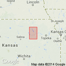
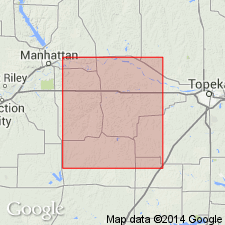
- Nemaha anticline
Summary:
Pg. 229, 233, 234, 235, 237. Eiss limestone in Garrison shale member of Council Grove formation. Consists of (descending): (1) dark-gray, siliceous, hard, massive, 1 foot-3 inches to 2 feet; (2) shale, bluish, argillaceous, with fine calcareous material, very fossiliferous, 7 feet; (3) limestone, dark-gray, earthy, hard on exposure, 1 foot-4 inches. Total thickness 9 to 10 feet. Underlies Easly Creek shale and overlies Stearns shale. Age is Permian. Report includes cross sections, measured sections, geologic maps, stratigraphic tables.
Named from Eiss farm, south of Humboldt. Recognized in eastern Kansas and southeastern Nebraska.
Source: Publication; US geologic names lexicon (USGS Bull. 896, p. 664-665).

- Usage in publication:
-
- Eiss limestone member
- Modifications:
-
- Principal reference
- Revised
- AAPG geologic province:
-
- Nemaha anticline
Summary:
Pg. 19. Eiss limestone member of Garrison formation of Council Grove group. Thickness 9 to 10 feet. Underlies Hooser shale member and overlies Stearns shale member, both of Garrison. Age is Permian (Big Blue).
Type exposure: in SE/4 sec. 3, T. 1 N. R. 13 E., on Eiss farm, 8 mi south of Humboldt, [Richardson Co.], southeastern NE.
Source: US geologic names lexicon (USGS Bull. 896, p. 664-665); GNC KS-NE Permian Corr. Chart, Oct. 1936.

- Usage in publication:
-
- Eiss limestone member
- Modifications:
-
- Revised
- AAPG geologic province:
-
- Forest City basin
Summary:
Pg. 7. Eiss limestone member of Bader limestone formation of Council Grove group. Consists of (descending): (1) grayish limestone, 1.25 to 2 feet; (2) olive argillaceous shale, 5 to 7 feet; (3) dark gray shaly limestone, 1.5 to 2 feet. Thickness 9.5 feet. Occurs above Stearns shale formation and below Hooser shale member of Bader. Age is Permian. [See also under Bader.]
Source: Publication; US geologic names lexicon (USGS Bull. 896, p. 664-665); GNC KS-NE Permian Corr. Chart, Oct. 1936.
- Usage in publication:
-
- Eiss limestone member
- Modifications:
-
- Revised
- AAPG geologic province:
-
- Forest City basin
Summary:
Pg. 61, 62. Rank reduced to member status in Bader limestone. Underlies Hooser shale member; overlies Stearns shale.
Source: US geologic names lexicon (USGS Bull. 1200, p. 1221).
- Usage in publication:
-
- Eiss limestone member
- Modifications:
-
- Areal extent
- AAPG geologic province:
-
- Forest City basin
Summary:
Pg. 78-79, pls. Thickness about 10.9 feet in Wabaunsee County, Kansas. Generally, consists of two shale beds of limestone and thin bed of shale. Underlies Hosser shale member; overlies Stearns shale.
Source: US geologic names lexicon (USGS Bull. 1200, p. 1221).
For more information, please contact Nancy Stamm, Geologic Names Committee Secretary.
Asterisk (*) indicates published by U.S. Geological Survey authors.
"No current usage" (†) implies that a name has been abandoned or has fallen into disuse. Former usage and, if known, replacement name given in parentheses ( ).
Slash (/) indicates name conflicts with nomenclatural guidelines (CSN, 1933; ACSN, 1961, 1970; NACSN, 1983, 2005, 2021). May be explained within brackets ([ ]).