The National Geologic Map Database is migrating to a new infrastructure. We apologize for any service disruptions during this process.
|
|---|


- Usage in publication:
-
- Egremont limestone
- Modifications:
-
- Original reference
- Dominant lithology:
-
- Limestone
- AAPG geologic province:
-
- New England province
Summary:
Pg. 717-736, 780-802. Egremont limestone. White to gray crystalline Iimestone, often quite pure but for small scales of colorless mica and grains of pyrite. Locally contains thin quartzitic or schistose layers. Generally passes upward into Everett schist through a graphitic layer of variable thickness, and a similar graphitic rock is also found at its lower contact with Riga schist. Correlated with Bellowspipe limestone of northwestern Massaschusetts. Included in Mount Washington series. Present in southwestern Massachusetts and northwestern Connecticut. Age is Ordovician and Cambrian.
Named for its wide extent in Egremont Valley [Berkshire Co., MA].
[GNC remark (ca. 1938, US geologic names lexicon, USGS Bull. 896, p. 664): [Egremont limestone =] part of Stockbridge limestone.]
Source: US geologic names lexicon (USGS Bull. 896, p. 664).
- Usage in publication:
-
- Egremont limestone*
- Modifications:
-
- Principal reference
- AAPG geologic province:
-
- New England province
Summary:
Pg. 35. Egremont limestone. Hobbs (1893, p. 725) correlated the Egremont with the Bellows Pipe [sic] Limestone. Later (1897, p. 175-177) Hobbs realized that the bulk of his Egremont is part of the underlying Stockbridge Limestone (= Canaan Limestone, Hobbs, 1893, p. 726) and accordingly restricted the Egremont Limestone to "the calcareous schist and limestone of the summit plain of Mount Washington" (1897, p. 177); he then substituted for Egremont the name Bellowspipe. An isolated area of thin-bedded to schistose limestone east of Washburn Mountain in Copake, New York (Copake 7.5-min quadrangle) was mapped as the Upper Cambrian Pine Plains Formation and basal limestone of the Trenton black slate by Weaver (1957, pl. 1). The rock is unfossiliferous but lithically resembles the Bellowspipe Limestone; it may eventually prove to be part of the Egremont Limestone in the restricted sense of Hobbs (1897; Zen, unpub. data). Age of the Egremont (restricted sense of Hobbs, 1897) may be Cambrian(?), if it is equated to the Bellowspipe Limestone through lithic and stratigraphic comparison. Synonymy listed.
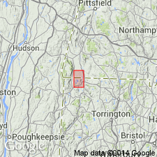
Type locality: town of Egremont, MA, Egremont 7.5-min quadrangle, MA-NY.
References cited:
Hobbs, W.H., 1897, Jour. Geol., v. 5, p. 175-177.
Weaver, J.D., 1957, GSA Bull., v. 68, p. 725-762, pl. 1 (Copake quadrangle).
Source: Publication.
- Usage in publication:
-
- Egremont Phyllite*
- Modifications:
-
- Mapped 1:24k
- Dominant lithology:
-
- Slate
- Phyllite
- AAPG geologic province:
-
- New England province
Summary:
Egremont Phyllite. Mapped in northwestern part of Bashbish quadrangle, in Mount Washington area, Berkshire County, Massachusetts. Described as carbonaceous, black to silvery gray, fine-grained quartzose silty slate and phyllite. Locally contains mm-thick white sandy laminae, rusty weathering layers, or impure limestone lenses several feet thick. May be same as Walloomsac Formation, which it closely resembles. Egremont in thrust fault contact with the Cambrian or Ordovician age Everett Formation. Isolated patches of dark-gray schist, lithologically resembling the Walloomsac or the Egremont, and apparently interlayered with the green schist of the Everett, are mapped as part of the Everett Formation. Age of the Egremont is Middle(?) Ordovician.
Source: Publication.
- Usage in publication:
-
- Egremont Phyllite*
- Modifications:
-
- Revised
- AAPG geologic province:
-
- New England province
Summary:
Egremont Phyllite. Hobbs (1893, p. 727) applied the name Egremont Limestone to the carbonate rocks of the Housatonic valley in southwestern Massachusetts and northwestern Connecticut, as well as to other rock types that occur in the Taconic Range just to the west. Hobbs described the latter types as follows: "As met with in the summit plains, the limestone appears under two [intergradational modifications]: (1) a very micaceous limestone or calcareous mica schist, (2) a graphitic schist, often, though not always, calcareous."
Hobbs (1897, p. 177) later realized that the bulk of his Egremont Limestone, occurring in the Housatonic valley, is part of the Stockbridge Limestone as the name was used by Dale (1891). He therefore restricted the name Egremont to the rock types of the "summit plains" and referred them to the Bellowspipe Limestone as defined by Dale (1891). These rocks have been called the Berkshire Schist by Emerson (1917) and Dale (1923); they were lumped with the Everett Schist by Fisher and others (in New York State Mus. and Sci. Serv., Geol. Survey, 1962). The evolution of nomenclature and its implications was summarized by Zen (1964, p. 35).
Recent study of the bedrock geology of the Bashbish Falls and Egremont quadrangles in southwestern Massachusetts by the author shows that Hobbs' original "summit plains" phase of the Egremont is a mappable unit. It is a gray to black phyllite, locally carrying interbedded phyllitic marble. This sequence resembles the Walloomsac Formation; the two units also hold similar relations to the overlying Everett Formation. However, the correlation of the Walloomsac with the "summit plains" phase of the Egremont cannot be proven, owing to structural complications. For this reason, the "summit plains" phase of the Egremont is hereby designated the Egremont Phyllite; it is of uncertain age, although probably early Paleozoic and possibly Middle Ordovician.
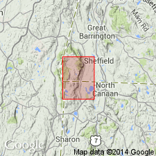
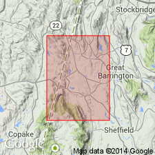
Type locality: in Egremont town, MA (Egremont quadrangle), where excellent exposures can be seen in Karner Brook.
References cited:
Dale, T.N., 1891, Amer. Geol., v. 8, p. 1-7 (Greylock synclinorium).
Dale, T.N., 1923, USGS Bull. 744, 71 p (The lime belt of MA, eastern NY, western CT).
Emerson, B.K., 1917, USGS Bull. 597, 289 p (Geol. of MA and RI).
Source: Publication.
For more information, please contact Nancy Stamm, Geologic Names Committee Secretary.
Asterisk (*) indicates published by U.S. Geological Survey authors.
"No current usage" (†) implies that a name has been abandoned or has fallen into disuse. Former usage and, if known, replacement name given in parentheses ( ).
Slash (/) indicates name conflicts with nomenclatural guidelines (CSN, 1933; ACSN, 1961, 1970; NACSN, 1983, 2005, 2021). May be explained within brackets ([ ]).