The National Geologic Map Database is migrating to a new infrastructure. We apologize for any service disruptions during this process.
|
|---|


- Usage in publication:
-
- Edinburg formation
- Modifications:
-
- Named
- Dominant lithology:
-
- Limestone
- Shale
- AAPG geologic province:
-
- Appalachian basin
Summary:
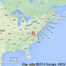
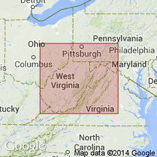
Edinburg formation proposed for stratigraphic interval above Lincolnshire limestone and below Reuschella "edsoni" zone of Oranda formation. In Shenandoah Valley, underlies Collierstown limestone. Includes two equivalent facies: one of cobbly to nodular buff-weathering limestone, the Lantz Mills facies, and the other of black limestone and shale, Liberty Hall facies, between the basal Botetourt limestone member and the St. Luke member near the top. Thickness at type locality near Edinburg, in Shenandoah Co., north-central VA, is 455 ft (139 m), and ranges to 1,348 ft (411 m) elsewhere. Correlates with substantial part of Chambersburg formation in PA.
Source: GNU records (USGS DDS-6; Reston GNULEX).
- Usage in publication:
-
- Edinburg Formation
- Modifications:
-
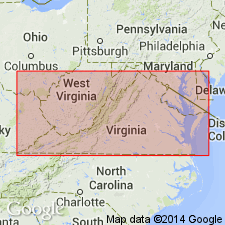
- Areal extent
- AAPG geologic province:
-
- Appalachian basin
Summary:
Edinburg Formation used on the State map of West Virginia where it is assigned to the Trenton Group. Age is Middle Ordovician. Underlies Oranda Formation; overlies Lincolnshire Formation. Present in Jefferson, Berkeley, and Morgan Cos.
Source: GNU records (USGS DDS-6; Reston GNULEX).
- Usage in publication:
-
- Edinburg Formation
- Modifications:
-
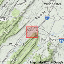
- Areal extent
- AAPG geologic province:
-
- Appalachian basin
Summary:
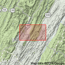
Edinburg Formation restricted from Pendleton Co., WV, on the basis of stratigraphic position and lithology.
Source: GNU records (USGS DDS-6; Reston GNULEX).
- Usage in publication:
-
- Edinburg Formation*
- Modifications:
-
- Overview
- AAPG geologic province:
-
- Appalachian basin
Summary:
Middle Ordovician Edinburg Formation of Cooper and Cooper (1946) is here adopted by the U.S. Geological Survey for use in north-central VA. Unit underlies Martinsburg Shale and overlies Lincolnshire Limestone.
Source: GNU records (USGS DDS-6; Reston GNULEX).
- Usage in publication:
-
- Edinburg Formation
- Modifications:
-
- Age modified
- AAPG geologic province:
-
- Appalachian basin
Summary:
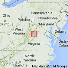
In the western anticlines of VA in Botetourt Co., the age of the Edinburg Formation is changed to Late Ordovician. Consists of fine-grained, dark gray to black, argillaceous, thin-bedded limestone with thin, interbedded black, calcareous shale. Thickness ranges from 370 to 425 feet. Common fossils include MASTOPORA, RECEPTACULITES, CRYPTOPHRAGMUS, and fragmental brachiopods and bryozoans. Unit overlies Lincolnshire Limestone and underlies Reedsville Formation; correlates with the Big Valley Formation, McGlone Formation, and Nealmont Limestone of Highland Co.
Source: GNU records (USGS DDS-6; Reston GNULEX).

- Usage in publication:
-
- Edinburg Formation*
- Modifications:
-
- Biostratigraphic dating
- AAPG geologic province:
-
- Appalachian basin
Summary:
Conodont biostratigraphy indicates that the Edinburg Formation in the Winchester 30 X 60 minute quadrangle is of Middle Ordovician (Blackriveran) age. Conodonts were recovered from the B. GERDAE Subzone of the A. TVAERENSIS Zone to the lowermost P. UNDATUS Zone.
Source: GNU records (USGS DDS-6; Reston GNULEX).
- Usage in publication:
-
- Edinburg Formation*
- Modifications:
-
- Revised
- AAPG geologic province:
-
- Appalachian basin
Summary:
Cobbly limestone previously assigned to the lowermost part of the Oranda Formation (abandoned herein) is placed at the top of the Edinburg Formation in the Shenandoah Valley of northern VA. About 7.5 feet of cobbly limestone was placed in the Oranda Formation by Cooper and Cooper (1946) based on fossil content. Lithologically, this interval is similar to the underlying Edinburg and is herein assigned to the top of the Edinburg. The remainder of the Oranda is part of the new Stickley Run Member of the Martinsburg Formation.
Source: GNU records (USGS DDS-6; Reston GNULEX).
For more information, please contact Nancy Stamm, Geologic Names Committee Secretary.
Asterisk (*) indicates published by U.S. Geological Survey authors.
"No current usage" (†) implies that a name has been abandoned or has fallen into disuse. Former usage and, if known, replacement name given in parentheses ( ).
Slash (/) indicates name conflicts with nomenclatural guidelines (CSN, 1933; ACSN, 1961, 1970; NACSN, 1983, 2005, 2021). May be explained within brackets ([ ]).