- Usage in publication:
-
- Edgemont Formation
- Modifications:
-
- Named
- Dominant lithology:
-
- Slate
- Phyllite
- Quartzite
- AAPG geologic province:
-
- Great Basin province
Summary:
Pg. 15, 36 (table 1), pI. 1. Edgemont Formation. Blue-gray to brown slate and phyllite; upper beds calcareous and lower more sandy (schistose quartzite). Thickness about 700 feet, uncertain because of close folding. Gradationally overlies Prospect Mountain Quartzite; disconformably (in part) underlies Porter Peak Limestone (new). Age is tentatively Early Cambrian, based on fossils (trilobite identified by Joseph Lintz, Univ. Nevada).
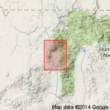
Type locality not designated. Named from Edgemont Canyon on west flank of Bull Run Mountains, Bull Run 15-min quadrangle, Elko Co., northeastern NV. Also exposed in syncline on east side of range between California and Sheridan Gulches and in four discontinuous east-west bands between Prospect Mountain Quartzite and Porter Peak Limestone.
Source: US geologic names lexicon (USGS Bull. 1350, p. 234); GNU records (USGS DDS-6; Menlo GNULEX).
For more information, please contact Nancy Stamm, Geologic Names Committee Secretary.
Asterisk (*) indicates published by U.S. Geological Survey authors.
"No current usage" (†) implies that a name has been abandoned or has fallen into disuse. Former usage and, if known, replacement name given in parentheses ( ).
Slash (/) indicates name conflicts with nomenclatural guidelines (CSN, 1933; ACSN, 1961, 1970; NACSN, 1983, 2005, 2021). May be explained within brackets ([ ]).

