- Usage in publication:
-
- Ector tongue
- Modifications:
-
- Original reference
- Dominant lithology:
-
- Chalk
Summary:
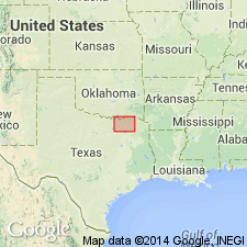
Pg. 149. Ector tongue of Austin chalk. A thin tongue-like projection of chalk from basal beds of main body of the Austin, has been traced, by means of a few outcrops and the black soils to which the chalk weathers, from western Fannin County, northeast to point about 1.5 miles southeast of Ravenna. Ector, for which the tongue is named, is a few hundred yards west of the belt of outcrop. Only 10 to 15 feet of the chalk was seen in best exposures, and it probably does not exceed 50 feet in thickness in vicinity of Ector [Fannin County]. The Ector tongue is underlain by shaly clay, with thin beds of sand and a basal conglomerate ("fish-bed conglomerate"), which are regarded as distinct from underlying Eagle Ford formation and are mapped with the Austin. [L.W. Stephenson now [ca. 1930] includes this shaly clay, sand, and "fish-bed conglomerate" in Ector tongue. See 1928, Amer. Jour. Sci., 5th ser., v. 16, p. 492; 1929, AAPG Bull., v. 13, no. 10.]
Source: US geologic names lexicon (USGS Bull. 896, p. 659).

- Usage in publication:
-
- Ector Chalk
- Modifications:
-
- Mapped 1:250k
- Dominant lithology:
-
- Chalk
- AAPG geologic province:
-
- Ouachita folded belt
- South Oklahoma folded belt
Summary:
Pamphlet [p. 3]. Ector Chalk of Austin Group. Chalk, light-gray, weathers to white, argillaceous, brittle. Thickness approximately 35 feet, feathers out eastward in Fannin County, central northern Texas [Ridings area]. Lies above Eagle Ford Formation and below Bonham Marl of Austin Group. Age is Late Cretaceous.
[Mapped in mostly continuous belt in northeastern part of map sheet in Fannin and Grayson Cos., northeastern TX.]
Source: Publication.
For more information, please contact Nancy Stamm, Geologic Names Committee Secretary.
Asterisk (*) indicates published by U.S. Geological Survey authors.
"No current usage" (†) implies that a name has been abandoned or has fallen into disuse. Former usage and, if known, replacement name given in parentheses ( ).
Slash (/) indicates name conflicts with nomenclatural guidelines (CSN, 1933; ACSN, 1961, 1970; NACSN, 1983, 2005, 2021). May be explained within brackets ([ ]).

