

- Usage in publication:
-
- Eaton greensand lentil
- Modifications:
-
- Original reference
- AAPG geologic province:
-
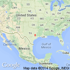
- East Texas basin
Summary:
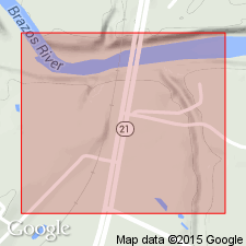
Pg. 78, 90-91. Eaton Greensand lentil of Claiborne Group. South of Eaton, in the vicinity of Shiloh School, southern Robertson County, in the A.W. Rowlett, Geo. W. Cox, northwestern corner of the Lavina Rollison, and southern part of the Jose Maria Viesca surveys, Robertson County, east-central Texas, there are marine beds interlaminated with Sparta sand member of Cook Mountain formation. These marine lenses consist of fossiliferous glauconitic sand, red clay, and ferruginous ironstone, all interbedded with gray sand of Sparta lithology. Maximum thickness (50 feet) is exposed along Wheelock-New Baden road, and interval from topmost marine bed in Eaton lentil to base of overlying Crockett member is 15 to 50 feet. [Age is middle Eocene.]
Source: US geologic names lexicon (USGS Bull. 896, p. 656-657).

- Usage in publication:
-
- Eaton lentil
- Modifications:
-
- Revised
- AAPG geologic province:
-
- East Texas basin
Summary:
Pg. 612. Eaton lentil of Crockett formation of Claiborne group. Showed Eaton lentil lying at base of the Crockett and lower in section than Moseley limestone. [Age is middle Eocene.]
Source: US geologic names lexicon (USGS Bull. 896, p. 656-657).
- Usage in publication:
-
- Eaton lentil (marine)
- Modifications:
-
- Revised
- AAPG geologic province:
-
- East Texas basin
Summary:
(Jan. 1935) p. 277. Crockett redefined to include only the 100 feet of beds above Moseley limestone. The Moseley limestone and underlying beds down to top of Sparta sand are here named Stone City beds. Latter includes Eaton lentil (marine) and are 85+/- feet thick. The disconformably underlie Crockett restricted. [Age is middle Eocene.]
Source: US geologic names lexicon (USGS Bull. 896, p. 656-657).

- Usage in publication:
-
- Eaton greensand lentil
- Modifications:
-
- Overview
- AAPG geologic province:
-
- East Texas basin
Summary:
Eaton greensand lentil in Claiborne group. Recognized in Robertson County, eastern central Texas. Age is middle Eocene.
Source: US geologic names lexicon (USGS Bull. 896, p. 656-657).
For more information, please contact Nancy Stamm, Geologic Names Committee Secretary.
Asterisk (*) indicates published by U.S. Geological Survey authors.
"No current usage" (†) implies that a name has been abandoned or has fallen into disuse. Former usage and, if known, replacement name given in parentheses ( ).
Slash (/) indicates name conflicts with nomenclatural guidelines (CSN, 1933; ACSN, 1961, 1970; NACSN, 1983, 2005, 2021). May be explained within brackets ([ ]).