The National Geologic Map Database is migrating to a new infrastructure. We apologize for any service disruptions during this process.
|
|---|


- Usage in publication:
-
- East Molokai volcanic series
- Modifications:
-
- Original reference
- Dominant lithology:
-
- Volcanics
- AAPG geologic province:
-
- Molokai
Summary:
Pg. 69 (table), 71-72. East Molokai volcanic series. Comprises all volcanic rocks of East Molokai Mountain (East Molokai Volcano) except Kalaupapa Peninsula. Divided into lower member (composed chiefly of thin-bedded basaltic aa and pahoehoe) and upper member (of oligoclase andesite and trachyte flows from cinder cones). Series is as much as 4,970 feet above sea level at Kamakou. Base is not exposed, though probably extends downward 12,000 feet to ocean floor. Overlies with erosional unconformity West Molokai volcanic series (new) and underlies with erosional unconformity Kalaupapa basalt (new). Age is considered Pliocene and older (stratigraphic correlation table on p. 23).
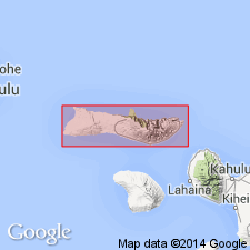
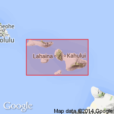
Named from East Molokai volcano, [Maui Co.], Island of Molokai, HI, which covers area 27 mi long and 8 mi wide, comprising almost all of East Molokai [Division] of Island of Molokai, HI.
[Hawaiian spelling: East Molokaʻi Division (U.S. Board on Geographic Names, ca. 2000).]
Source: US geologic names lexicon (USGS Bull. 1200, p. 1205-1206); GNU records (USGS DDS-6; Menlo GNULEX).
- Usage in publication:
-
- East Molokai volcanic series*
- Modifications:
-
- Age modified
- AAPG geologic province:
-
- Molokai
Summary:
Type locality of lower and upper members in 1800 ft cliff separating Kalaupapa Peninsula from rest of island, along trail down Pali SW of Kalaupapa [21 deg 11' 33"N, 156 deg 59' 10"W, Kaunakakai 7.5' quad, Island of Molokai, HI]. Total thickness of stratigraphic section at type locality is 1610 ft. Map gives Pliocene age.
Source: GNU records (USGS DDS-6; Menlo GNULEX).
- Usage in publication:
-
- East Molokai volcanic series*
- Modifications:
-
- Age modified
- AAPG geologic province:
-
- Molokai
Summary:
Lower part of unit picrite basalts are oceanite type; upper part consists of ankaramite type. Small stocks of gabbro intrude basalts. Map shows Pliocene(?) age.
Source: GNU records (USGS DDS-6; Menlo GNULEX).
- Usage in publication:
-
- East Molokai volcanic series*
- Modifications:
-
- Geochronologic dating
- AAPG geologic province:
-
- Molokai
Summary:
K-Ar ages on samples on Kalae to Kalaupapa trail from lower member of unit range from 1.49 to 1.47 Ma. Samples from upper member range from 1.46 to 1.31 Ma.
Source: GNU records (USGS DDS-6; Menlo GNULEX).
- Usage in publication:
-
- East Molokai Volcanic Series*
- Modifications:
-
- [Principal reference]
- AAPG geologic province:
-
- Molokai
Summary:
Stratigraphic section at type locality [21 deg 11' 33"N, 156 deg 59' 10"W, Kaunakakai 7.5' quad] of Stearns and Macdonald (1947) is designated type section for East Molokai Volcanic Series and referred to as "Kalaupapa section".
Source: GNU records (USGS DDS-6; Menlo GNULEX).
- Usage in publication:
-
- East Molokai Volcanic Series*
- Modifications:
-
- Geochronologic dating
- AAPG geologic province:
-
- Molokai
Summary:
K-Ar ages on samples from lower member of unit at Halawa Valley [Island of Molokai] yielded mean of 1.75 +/-.07 Ma.
Source: GNU records (USGS DDS-6; Menlo GNULEX).

- Usage in publication:
-
- East Molokai Volcanics*
- Modifications:
-
- Revised
- AAPG geologic province:
-
- Molokai
Summary:
East Molokai Volcanic Series [Stearns, 1946] is reduced in rank and renamed East Molokai Volcanics. K-Ar ages from McDougall (1964) and Naughton and others (1980) yield Pleistocene for most of flows, but some of the lower member flows are Pliocene.
Source: GNU records (USGS DDS-6; Menlo GNULEX).
For more information, please contact Nancy Stamm, Geologic Names Committee Secretary.
Asterisk (*) indicates published by U.S. Geological Survey authors.
"No current usage" (†) implies that a name has been abandoned or has fallen into disuse. Former usage and, if known, replacement name given in parentheses ( ).
Slash (/) indicates name conflicts with nomenclatural guidelines (CSN, 1933; ACSN, 1961, 1970; NACSN, 1983, 2005, 2021). May be explained within brackets ([ ]).