- Usage in publication:
-
- East Fork formation
- Modifications:
-
- First used
- Dominant lithology:
-
- Shale
- Sandstone
- Coal
- AAPG geologic province:
-
- Mackenzie trough
Summary:
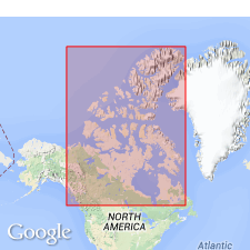
First used as formation in vicinity of Mackenzie River Valley, Mackenzie trough, Northwest territories, CN. Derivation of name not given; apparently named for East Fork of Little Bear River, noted to be type locality. Overlies Little Bear formation (new); underlies undifferentiated Tertiary. Consists of well-bedded gray, conchoidal, and plastic marine shale; near base are some thin, calcareous sandstone members and a thin coal seam (about 12 in thick and containing fossil resin) was observed on a small tributary. Is 850 ft thick at type. Is not recognized north of Little Bear River. Late Cretaceous age is assumed from stratigraphic relations and observed fossils, but no records of collections or study of fossils available.
Source: GNU records (USGS DDS-6; Denver GNULEX).
For more information, please contact Nancy Stamm, Geologic Names Committee Secretary.
Asterisk (*) indicates published by U.S. Geological Survey authors.
"No current usage" (†) implies that a name has been abandoned or has fallen into disuse. Former usage and, if known, replacement name given in parentheses ( ).
Slash (/) indicates name conflicts with nomenclatural guidelines (CSN, 1933; ACSN, 1961, 1970; NACSN, 1983, 2005, 2021). May be explained within brackets ([ ]).

