

- Usage in publication:
-
- East Bluff member
- Modifications:
-
- Original reference
- Dominant lithology:
-
- Gravel
- Sand
- Clay
- AAPG geologic province:
-
- Wisconsin arch
Summary:
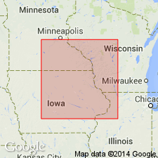
Pg. 599, 606 (fig. 2), 607-610. East Bluff Member of Windrow Formation. Proposed to include coarser clastic deposits of formation which commonly rest conformably on older ferruginous deposits here named Iron Hill member. Term Ostrander member of Dakota formation has been applied to these deposits in southeastern Minnesota by Stauffer and Thiel (1941). Thwaites and Twenhofel (1921) refer these deposits to Windrow. Section in Fillmore County, Minnesota, consists of 20 feet of lensing units of gray clay, sand, and sandy clay, with beds of iron oxide near base; channel fillings of small well-sorted quartz and chert pebbles, granules, grit, and sand common; channel deposits occasionally show cross-lamination. Underlies Kansan drift. Occurs in southwestern Wisconsin, northwestern Iowa, and southwestern Minnesota. Age is Cretaceous.
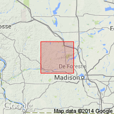
Named from exposures on the East Bluff in Devils Lake State Park, Sauk Co., south-central WI.
Source: US geologic names lexicon (USGS Bull. 1200, p. 1201).
- Usage in publication:
-
- East Bluff Member†
- Modifications:
-
- Abandoned
- AAPG geologic province:
-
- Wisconsin arch
Summary:
Pg. 33-35. †East Bluff Member of Windrow Formation. Abandoned. Not a valid stratigraphic unit. Only reported occurrence of supposed Windrow Formation in Sauk County, Wisconsin, is on East Bluff, on east side of Devils Lake gorge. The Windrow has not been observed in place in surrounding area. Andrews' East Bluff Member = loose, scattered pebbles in potholes scoured into surface of quartzite at top of bluff and in side of the gorge, or lag pebbles in Pleistocene slope deposits.
Source: Publication.
For more information, please contact Nancy Stamm, Geologic Names Committee Secretary.
Asterisk (*) indicates published by U.S. Geological Survey authors.
"No current usage" (†) implies that a name has been abandoned or has fallen into disuse. Former usage and, if known, replacement name given in parentheses ( ).
Slash (/) indicates name conflicts with nomenclatural guidelines (CSN, 1933; ACSN, 1961, 1970; NACSN, 1983, 2005, 2021). May be explained within brackets ([ ]).