


- Usage in publication:
-
- Easly Creek shale*
- Modifications:
-
- Original reference
- Dominant lithology:
-
- Shale
- AAPG geologic province:
-
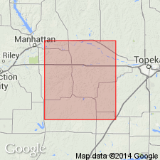
- Forest City basin
Summary:
Pg. 229-237. Easly Creek shale in Garrison shale member of Council Grove formation. Consists of (descending): (1) shale, in blue, gray, greenish-gray, and reddish bands, in part quite calcareous, 12 feet; (2) gray limestone, 2 to 4 feet; (3) shale, with one limestone band 2 to 3 inches thick, 10 to 12 feet. Total thickness 26 feet. Overlies Eiss limestone and underlies Sabetha limestone. Age is Permian. Report includes cross sections, measured sections, geologic maps, stratigraphic tables.
Named from outcrops on Easly Creek, Richardson Co., southeastern NE.
Source: Publication; US geologic names lexicon (USGS Bull. 896, p. 652).

- Usage in publication:
-
- Easly Creek shale member
- Modifications:
-
- Revised
- AAPG geologic province:
-
- Nemaha anticline
Summary:
Pg. 19, 21. Easly Creek shale member of Garrison formation of Council Grove group. Easly Creek shale of Condra (1927) is here divided into (descending): Easly Creek shale restricted, Middleburg limestone, and Hooser shale. The Easly Creek shale as now constituted is about 14 feet thick in Nebraska and northern Kansas and about 11 feet near Oklahoma line. At places there is a bed of gypsum in this member, as in vicinity of Blue Rapids, Kansas. It underlies Crouse limestone (same as "Sabetha limestone" and has 10 years priority). Age is Permian.
Type locality: on Easly Creek, in NE/4 sec. 35, T. 1 N., R. 13 E., about 10 mi south and 1.25 mi east of Humboldt, Richardson Co., southeastern NE.
Source: US geologic names lexicons (USGS Bull. 896, p. 652; USGS Bull. 1200, p. 1200); GNC KS-NE Permian Corr. Chart, Oct. 1936.

- Usage in publication:
-
- Easly Creek shale
- Modifications:
-
- Revised
Summary:
Pg. 46. Easly Creek shale. Consists of red, green, and gray shale, partly calcareous and containing local limestone beds; upper part is light colored and calcareous; lower part largely red shale; locally contains gypsum bed near base. Thickness approximately 15 to 20 feet. Underlies Crouse limestone; overlies Bader limestone. Age is Permian.
Source: US geologic names lexicon (USGS Bull. 1200, p. 1200).
- Usage in publication:
-
- Easly Creek shale*
- Modifications:
-
- Areal extent
- AAPG geologic province:
-
- Forest City basin
Summary:
Pg. 13 (table 2), 81-82. Easly Creek shale was named by Condra (1927) who described it as member of Garrison shale and defined it as beds from top of Eiss limestone to base of Crouse limestone. Condra and Upp (1931, Nebraska Geol. Survey Bull., no. 6, 2nd ser.) redefined Easly Creek to include beds between Middleburg limestone [member of Bader limestone] and Crouse limestone. This is classification followed in present report [Wabaunsee County, Kansas]. Thickness 10 to 18 feet. Age is Permian.
See also "Modern classifications of the Permian rocks of Kansas and Nebraska," compiled by M.G. Wilmarth, Secretary of Committee on Geologic Names, USGS unpub. corr. chart, Oct. 1936, 1 sheet.
Source: US geologic names lexicon (USGS Bull. 1200, p. 1200).
For more information, please contact Nancy Stamm, Geologic Names Committee Secretary.
Asterisk (*) indicates published by U.S. Geological Survey authors.
"No current usage" (†) implies that a name has been abandoned or has fallen into disuse. Former usage and, if known, replacement name given in parentheses ( ).
Slash (/) indicates name conflicts with nomenclatural guidelines (CSN, 1933; ACSN, 1961, 1970; NACSN, 1983, 2005, 2021). May be explained within brackets ([ ]).