- Usage in publication:
-
- Eagle evaporite member
- Modifications:
-
- Areal extent
- Overview
- AAPG geologic province:
-
- Eagle basin
- Piceance basin
- Green River basin
Summary:
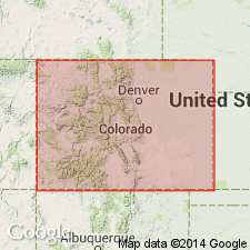
Considered to be a member of Minturn formation. Also designated "Eagle evaporites" in report. Forms conspicuous outcrops along U.S. Hwy 6-24 between Eagle and Dotsero, Eagle Co, CO, Eagle basin, and along State Hwy 82 between Glenwood Springs and Carbondale, Garfield Co, CO, Piceance basin. Deposited in a trough (isopach map) that was bordered by Uncompahgre uplift on west and Front Range highland on east during Desmoinesian time. Lithologies include mostly anhydrite and gypsum, and minor amounts of limestone, dolomite, siltstone, sandstone, shale, and sedimentary breccia (not noted by Murray, 1958). Breccia beds are most common near edges of basin. Beds are highly contorted. Maximum thickness near town of Eagle estimated to be in excess of 4,000 ft. Southern limit of evaporites probably near Leadville. Western limit probably near the Grand Hogback. Present in subsurface of Rio Blanco Co (Piceance basin), Moffat and Routt Cos (Greater Green River basin). Cross section. Transitional with underlying Belden formation and with overlying Minturn formation. Of Des Moines, Pennsylvanian age.
Source: GNU records (USGS DDS-6; Denver GNULEX).

- Usage in publication:
-
- Eagle evaporite member
- Modifications:
-
- First used
- Dominant lithology:
-
- Anhydrite
- Gypsum
- AAPG geologic province:
-
- Eagle basin
Summary:
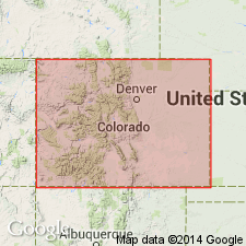
First published use as a member of Minturn formation. Named by Murray (unpub thesis, Univ. of CO, 1950) for exposures near town of Eagle, Eagle Co, CO in the Eagle basin. Name applied to thick evaporite deposit in central part of Maroon trough. Carbonates and shales and the evaporite are part of the middle zone of the Minturn. Overlies lower zone (gray, tan to pink, feldspathic, cross-bedded sandstone and conglomerate) of Minturn. Underlies upper zone (red and gray conglomerate, sandstone and shale) of Minturn. No discussion of type locality. No detailed discussion of lithology of evaporite except that it includes gypsum and anhydrite. Evaporites not reported south of Glenwood Springs. Considered Desmoinesian age. Cross section.
Source: GNU records (USGS DDS-6; Denver GNULEX).
For more information, please contact Nancy Stamm, Geologic Names Committee Secretary.
Asterisk (*) indicates published by U.S. Geological Survey authors.
"No current usage" (†) implies that a name has been abandoned or has fallen into disuse. Former usage and, if known, replacement name given in parentheses ( ).
Slash (/) indicates name conflicts with nomenclatural guidelines (CSN, 1933; ACSN, 1961, 1970; NACSN, 1983, 2005, 2021). May be explained within brackets ([ ]).

