

- Usage in publication:
-
- Eagle Creek conglomerate
- Modifications:
-
- Named
- Dominant lithology:
-
- Conglomerate
- Volcanics
- AAPG geologic province:
-
- Cascades province
- Columbia basin
Summary:
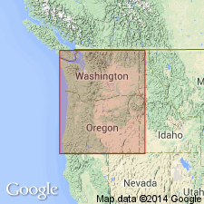
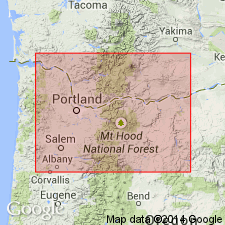
Eagle Creek conglomerate occurs a little west of Carson [southwest WA] and, what is less common, a flow or lava-filled variety of it. Occasional outcrops also occur west of town of Wyeth, Multnomah Co, OR. Underlies Columbia River basalt. Overlain by Carson lava as Carson Creek is approached. Shown on geologic map of Columbia River Gorge region as Miocene (probably late Miocene) age.
Source: GNU records (USGS DDS-6; Menlo GNULEX).
- Usage in publication:
-
- Eagle Creek formation
- Modifications:
-
- Redescribed
- Age modified
- Dominant lithology:
-
- Conglomerate
- Ash
- Tuff
- AAPG geologic province:
-
- Cascades province
- Columbia basin
Summary:
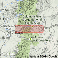
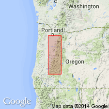
Eagle Creek conglomerate of Williams (1916) is here called Eagle Creek formation which is exposed along bottom of Columbia River Gorge from Warrendale to Viento on Oregon side with corresponding distribution on north side of river. Composed of volcanic conglomerate, ash, and tuffs with conglomerate most conspicuous near top surface. Is oldest formation recognized in region. Is 500 ft thick at Bonneville, OR and 2700 ft at Red Bluffs, WA. Base is not exposed. Unconformably underlies Columbia River lava. Tentatively considered late Eocene in age based on small amount of fossil flora.
Source: GNU records (USGS DDS-6; Menlo GNULEX).
- Usage in publication:
-
- Eagle Creek formation*
- Modifications:
-
- Adopted
- AAPG geologic province:
-
- Cascades province
- Columbia basin
Summary:
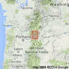
Eagle Creek formation is exposed beneath Columbia River basalt sheets in Columbia River Gorge in vicinity of Cascade Locks. Eagle Creek formation consists mainly of volcanic ash, pumice, and other volcanic materials along with sands, gravels, and shales. It contains fossil wood and fossil leaves.
Source: GNU records (USGS DDS-6; Menlo GNULEX).
- Usage in publication:
-
- Eagle Creek formation
- Modifications:
-
- Areal extent
- Age modified
- AAPG geologic province:
-
- Cascades province
- Columbia basin
Summary:
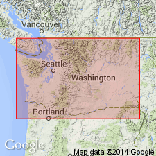
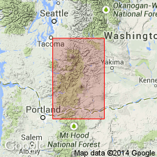
Described in Skamania Co, WA, where it underlies Skamania andesites (new) and is intruded by Silver Star granodiorite (new). Age is Oligocene(?).
Source: GNU records (USGS DDS-6; Menlo GNULEX).
- Usage in publication:
-
- Eagle Creek formation
- Modifications:
-
- Age modified
- AAPG geologic province:
-
- Cascades province
- Columbia basin
Summary:
In Columbia River Gorge, Columbia River basalt lies on erosional surface cut in sedimentary deposits of Eagle Creek formation. Chaney (1944, Carneige Inst. Washington Pub. 553) assigned fossil flora of Eagle Creek formation to early Miocene age.
Source: GNU records (USGS DDS-6; Menlo GNULEX).
- Usage in publication:
-
- Eagle Creek Formation*
- Modifications:
-
- Revised
- AAPG geologic province:
-
- Cascades province
- Columbia basin
Summary:
"Bull Creek Beds [Barnes and Butler, 1930] were separated from overlying flows, breccia, and tuff of the Eagle Creek Formation (part of the Little Butte Volcanic Series of this report), because the Bull Creek Beds dip steeply in contrast to the almost flat-lying strata of the Eagle Creek Formation." p.25
Source: GNU records (USGS DDS-6; Menlo GNULEX).
- Usage in publication:
-
- Eagle Creek Formation
- Modifications:
-
- Revised
- Overview
- AAPG geologic province:
-
- Cascades province
- Columbia basin
Summary:
Because an unconformity has been found within unit, Eagle Creek Formation is herein redefined as sequence of volcanic conglomerates, sandstones, and tuffs that are typically exposed south of Columbia River along Eagle Creek. In Wind River area, Skamania Co, WA, unit is best exposed around Table Mountain and Greenleaf Peak and along Hamilton Creek. Is 1300 ft thick in upper part of Hamilton Creek. Includes informally designated Hamilton Creek flow, Rock Creek flow, and Red Bluffs beds. Age is early Miocene based on biostratigraphic dating of flora (Chaney, 1959).
Source: GNU records (USGS DDS-6; Menlo GNULEX).
- Usage in publication:
-
- Eagle Creek Formation
- Modifications:
-
- Revised
- AAPG geologic province:
-
- Cascades province
- Columbia basin
Summary:
Eagle Creek Formation included in Western Cascades Group. Unit described as interstratified light-brown to gray clayey conglomerate with abundant dark-colored porphyritic andesite clasts, laharic breccia, pebbly volcaniclastic sandstone, siltstone, and few beds of air-fall tuff. Thickness is 150 to 365 m. Exposed along Columbia River Gorge and along Indian Heaven fissure zone. Age is early Miocene.
Source: GNU records (USGS DDS-6; Menlo GNULEX).
For more information, please contact Nancy Stamm, Geologic Names Committee Secretary.
Asterisk (*) indicates published by U.S. Geological Survey authors.
"No current usage" (†) implies that a name has been abandoned or has fallen into disuse. Former usage and, if known, replacement name given in parentheses ( ).
Slash (/) indicates name conflicts with nomenclatural guidelines (CSN, 1933; ACSN, 1961, 1970; NACSN, 1983, 2005, 2021). May be explained within brackets ([ ]).