- Usage in publication:
-
- Dynneson Sandstone Member
- Modifications:
-
- Named
- Dominant lithology:
-
- Sandstone
- AAPG geologic province:
-
- Williston basin
Summary:
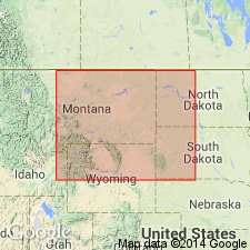
Named as basal member of Mowry Shale in Williston basin area. Is also one of three named lithofacies--Dynneson, Bow Island, lower Mowry--assigned to "Dynneson unit." Type section of member is interval between 5,320 and 5,450 ft in Sun Dynneson Well No. 1, sec 30, T24N, R58E, Richland Co, MT. Considered to be a blanket-type sandstone that covers approximately 30,000 sq mi in east MT and west ND. Known only in subsurface. Isopach and lithofacies map shows three lithofacies of Dynneson unit. Thickness estimated from area on isopach map of Dynneson unit range from 0 to 125 ft. The member is a white, buff to dark gray, subround to round, mainly quartz sandstone. Some beds are calcareous, micaceous, bentonitic, hard, tight. Sorting is fair to excellent. Sorting, rounding, and quartz content increase upward in member. A few thin beds of bentonite, siltstone, and black shale are interbedded. Some wood fragments. Interpreted to be an extensive shelf sand deposited in quiet water and reworked by waves. Cross sections. Description of samples at type. Nomenclature chart. Underlain by black shale of Skull Creek Shale, and locally by Newcastle Sandstone Member of Skull Creek. Overlain by black shale of upper part of Mowry. Lower contact is a disconformity. Upper contact is a prominent bentonite in middle of Mowry. No fossils found. Assigned a late Albian, Early Cretaceous age. Was previously the "so-called Newcastle."
Source: GNU records (USGS DDS-6; Denver GNULEX).
For more information, please contact Nancy Stamm, Geologic Names Committee Secretary.
Asterisk (*) indicates published by U.S. Geological Survey authors.
"No current usage" (†) implies that a name has been abandoned or has fallen into disuse. Former usage and, if known, replacement name given in parentheses ( ).
Slash (/) indicates name conflicts with nomenclatural guidelines (CSN, 1933; ACSN, 1961, 1970; NACSN, 1983, 2005, 2021). May be explained within brackets ([ ]).

