

- Usage in publication:
-
- Duzel formation*
- Modifications:
-
- Original reference
- Dominant lithology:
-
- Graywacke
- AAPG geologic province:
-
- Klamath Mountains province
Summary:
Pg. 645-646, 647 (fig. 1), pl. 1. Duzel formation. Proposed for sequence of pale-gray-green phyllitic graywackes. Crumpled structure is most distinctive feature. The graywacke is thinly layered and fissile; in general, it is layered at 1- to 2-mm intervals, although occasional beds up to 3 inches occur, and some a foot to 18 inches thick crop out at stratigraphic intervals of 1 to several hundred feet. Such beds are hard in contrast to the fragile thin layers. Limestone and associated chert beds occur within the phyllite. Many are less than 2 feet thick, but others as much as 200 feet in outcrop width are conspicuous in Horseshoe Gulch and to northeast along the ridge. The largest is more than a mile long and several hundred feet thick. Attitudes of beds indicate that the Duzel is involved in northward-plunging synclinorium, the east limb of which has been thrust over beds of younger Gazelle formation (new). In southern part of area, the syncline has been cut off by steeply dipping northward-trending fault which has dropped beds of the Duzel against peridotite and quartz-mica schist. Because top of Duzel is not exposed and base is uncertain, total thickness cannot be determined; below Duzel Rock, 1,250 feet of crinkled phyllite and phyllitic graywacke is exposed, but structure of the formation indicates its total thickness must be many times this figure. Contains coral and brachiopod fauna and is oldest fossil-bearing formation in Klamath Mountains. Age is Late Ordovician(?).
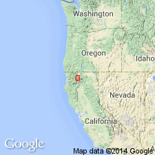
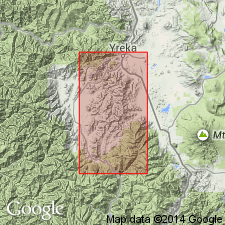
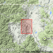
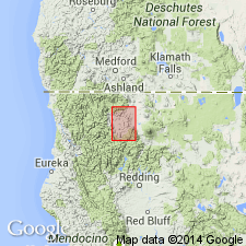
[Type locality not stated.] Occurs in two valleys south of Yreka, Siskiyou Co., northern CA. Crops out in drainage basin of Moffett Creek. Named from Duzel Creek, a tributary of Moffett Creek, which is just east of Duzel Rock, conspicuoiis mass of white marble that caps highest peak in area.
Source: US geologic names lexicon (USGS Bull. 1200, p. 1189).
- Usage in publication:
-
- Duzel Formation†
- Modifications:
-
- Abandoned
- AAPG geologic province:
-
- Klamath Mountains province
Summary:
Pg. 46. Duzel Formation abandoned as no longer considered valid formational unit; its rocks will be included in six lithologic units to be established. [Fate of the Callahan Chert Member not discussed in USGS Bull. 1422-A.]
Source: Changes in stratigraphic nomenclature, 1975 (USGS Bull. 1422-A, p. A10-A11).
- Usage in publication:
-
- Duzel Phyllite*
- Modifications:
-
- Reinstated
- Revised
- AAPG geologic province:
-
- Klamath Mountains province
Summary:
Duzel Formation reinstated for its type area and renamed Duzel Phyllite. Conformably(?) overlies Sissel Gulch Graywacke (new) and, elsewhere, thrust over Gazelle and Moffett Creek (new) Formations and Schulmeyer Gulch sequence.
[Fate of the Callahan Chert Member not discussed in USGS Bull. 1457-A.]
Source: Changes in stratigraphic nomenclature, 1977 (USGS Bull. 1457-A, p. A24-A25).
- Usage in publication:
-
- Duzel Phyllite*
- Modifications:
-
- Age modified
- AAPG geologic province:
-
- Klamath Mountains province
Summary:
Age changed from Late Ordovician(?) --to-- Ordovician and (or) Silurian.
Source: Changes in stratigraphic nomenclature, 1977 (USGS Bull. 1457-A, p. A25).
For more information, please contact Nancy Stamm, Geologic Names Committee Secretary.
Asterisk (*) indicates published by U.S. Geological Survey authors.
"No current usage" (†) implies that a name has been abandoned or has fallen into disuse. Former usage and, if known, replacement name given in parentheses ( ).
Slash (/) indicates name conflicts with nomenclatural guidelines (CSN, 1933; ACSN, 1961, 1970; NACSN, 1983, 2005, 2021). May be explained within brackets ([ ]).