

- Usage in publication:
-
- Dunlap limestone
- Modifications:
-
- Original reference
- Dominant lithology:
-
- Limestone
- AAPG geologic province:
-
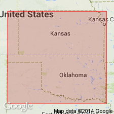
- Forest City basin
- Nemaha anticline
Summary:
Pg. 81, 82. Dunlap limestone. Two limestones, separated by 9 to 20 feet of shale. Separated from overlying Cottonwood Falls limestone by 25 to 30 feet of shale and from underlying Americus limestone by 50 feet of shale. Age is Pennsylvanian. Report includes cross section.
Source: US geologic names lexicon (USGS Bull. 896, p. 643).

- Usage in publication:
-
- Dunlap limestone†
- Modifications:
-
- Abandoned
Summary:
†Dunlap limestone. For many years considered same as later but better-established name Neva limestone. According to Condra (Nebraska Geol. Survey Paper, no. 1, 1933, p. 8) it includes more than true Neva limestone and is = his Grenola formation. See under Grenola formation and Neva limestone.
Source: US geologic names lexicon (USGS Bull. 896, p. 643).
For more information, please contact Nancy Stamm, Geologic Names Committee Secretary.
Asterisk (*) indicates published by U.S. Geological Survey authors.
"No current usage" (†) implies that a name has been abandoned or has fallen into disuse. Former usage and, if known, replacement name given in parentheses ( ).
Slash (/) indicates name conflicts with nomenclatural guidelines (CSN, 1933; ACSN, 1961, 1970; NACSN, 1983, 2005, 2021). May be explained within brackets ([ ]).