The National Geologic Map Database is migrating to a new infrastructure. We apologize for any service disruptions during this process.
|
|---|


- Usage in publication:
-
- Dunkard Creek series*
- Modifications:
-
- Named
- AAPG geologic province:
-
- Appalachian basin
Summary:
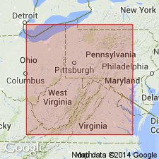
Dunkard Creek series, on Dunkard Creek, Greene County, Pennsylvania, includes 165 feet concealed beds above Gilmore sandstone and extends down to base of Cassville shales.
Source: GNU records (USGS DDS-6; Reston GNULEX).
- Usage in publication:
-
- Dunkard division
- Modifications:
-
- Revised
- AAPG geologic province:
-
- Appalachian basin
Summary:
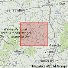
Permian strata in Ohio are grouped under term Dunkard, which has been given rank of group by the USGS, and of series in earlier publications of the Ohio Geological Survey. Washington and Greene subdivisions of Dunkard have been classified as formations. Latter are herein raised to series rank, thus making main subdivisions of Permian the same stratigraphic rank as those in Pennsylvanian. Dunkard becomes a sort of superseries and is superfluous. Term in Ohio is synonymous with term Permian. In this report, term Dunkard division is used in order to keep term under consideration until decision is made as to its validity in current stratigraphic usage.
Source: GNU records (USGS DDS-6; Reston GNULEX).
- Usage in publication:
-
- Dunkard Formation*
- Modifications:
-
- Revised
- Areal extent
- AAPG geologic province:
-
- Appalachian basin
Summary:
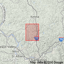
Rank changed from Dunkard Group to Dunkard Formation for use in vicinity of Sissonville quadrangle, Kanawha, Jackson, and Putnam Counties, West Virginia.
Source: GNU records (USGS DDS-6; Reston GNULEX).
For more information, please contact Nancy Stamm, Geologic Names Committee Secretary.
Asterisk (*) indicates published by U.S. Geological Survey authors.
"No current usage" (†) implies that a name has been abandoned or has fallen into disuse. Former usage and, if known, replacement name given in parentheses ( ).
Slash (/) indicates name conflicts with nomenclatural guidelines (CSN, 1933; ACSN, 1961, 1970; NACSN, 1983, 2005, 2021). May be explained within brackets ([ ]).