The National Geologic Map Database is migrating to a new infrastructure. We apologize for any service disruptions during this process.
|
|---|


- Usage in publication:
-
- Dunham dolomite
- Modifications:
-
- First used
- AAPG geologic province:
-
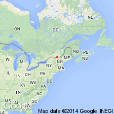
- New England province
Summary:
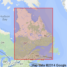
Dunham dolomite used as part of the Early Cambrian Oak Hill series in Quebec, Canada.
Source: GNU records (USGS DDS-6; Reston GNULEX).
- Usage in publication:
-
- Dunham dolomite
- Modifications:
-
- Named
- Dominant lithology:
-
- Dolomite
- AAPG geologic province:
-
- New England province
Summary:
Named for town of Dunham, Quebec province, Canada. Type locality is at Oak Hill, Sutton quad, Quebec. Consists of dark-gray, sometimes black, brown-weathering, crystalline rock. Thickness from 30 to 120 ft. Underlies Oak Hill slate; conformably overlies Gilman quartzite. Age is Early Cambrian.
Source: GNU records (USGS DDS-6; Reston GNULEX).
- Usage in publication:
-
- Dunham dolomite
- Modifications:
-
- Areal extent
- Revised
- Biostratigraphic dating
- AAPG geologic province:
-
- New England province
Summary:
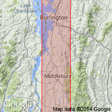
Geographically extended into west-central VT. Mallett member (rank reduced) assigned to upper part of the Dunham. Contains OLENELLUS and PTYCHOPARELLA, thus establishing Early Cambrian age.
Source: GNU records (USGS DDS-6; Reston GNULEX).
- Usage in publication:
-
- Dunham Dolostone*
- Modifications:
-
- Revised
- AAPG geologic province:
-
- New England province
Summary:
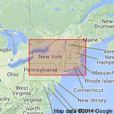
Revised as Dunham Dolostone for southwest VT and the Oak Hill and Richmond areas of Quebec.
Source: GNU records (USGS DDS-6; Reston GNULEX).

- Usage in publication:
-
- Dunham Dolomite*
- Modifications:
-
- Areal extent
- AAPG geologic province:
-
- New England province
Summary:
Stratigraphic succession in Middlebury synclinorium in north-central part of Glens Falls quad consists of (ascending) Late Proterozoic Dalton Formation and Pinnacle Formation, Lower Cambrian Cheshire Quartzite, Lower and Middle Cambrian dolomites (Rutland Dolomite, Dunham Dolomite as used by Cady (1945), Winooski Dolomite) with minor quartzite (Monkton Formation), and Upper Cambrian Danby Formation. Middlebury synclinorium is considered a parautochthonous shelf sequence.
Source: GNU records (USGS DDS-6; Reston GNULEX).
For more information, please contact Nancy Stamm, Geologic Names Committee Secretary.
Asterisk (*) indicates published by U.S. Geological Survey authors.
"No current usage" (†) implies that a name has been abandoned or has fallen into disuse. Former usage and, if known, replacement name given in parentheses ( ).
Slash (/) indicates name conflicts with nomenclatural guidelines (CSN, 1933; ACSN, 1961, 1970; NACSN, 1983, 2005, 2021). May be explained within brackets ([ ]).