The National Geologic Map Database is migrating to a new infrastructure. We apologize for any service disruptions during this process.
|
|---|


- Usage in publication:
-
- Dun limestone
- Modifications:
-
- Original reference
- Dominant lithology:
-
- Limestone
- AAPG geologic province:
-
- Cherokee basin
Summary:
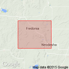
Pg. 7. Dun limestone. Limestone, 100 feet thick, in middle of interval between Fall River sandstone and Neodesha limestones in Wilson County, southeastern Kansas. Probably same as thick Humboldt limestone of Neosho Valley, having some irregularity of structure and apparently same fossils. Separated from underlying Neodesha sandstone by 80 to 100 feet of shale and from overlying Fall River sandstone by 145 feet of shale, limestone, and sandstone. Age is Pennsylvanian.
Named from Dun, Wilson Co., southeastern KS.
Source: US geologic names lexicon (USGS Bull. 896, p. 640).

- Usage in publication:
-
- Dun limestone†
- Modifications:
-
- Abandoned
Summary:
Pg. 124. †Dun limestone of Hay included Plattsburg, Vilas, and Stanton formations of Lansing group.
Source: US geologic names lexicon (USGS Bull. 896, p. 2297); GNC KS-NE Pennsylvanian Corr. Chart, sheet 2, Oct. 1936.
For more information, please contact Nancy Stamm, Geologic Names Committee Secretary.
Asterisk (*) indicates published by U.S. Geological Survey authors.
"No current usage" (†) implies that a name has been abandoned or has fallen into disuse. Former usage and, if known, replacement name given in parentheses ( ).
Slash (/) indicates name conflicts with nomenclatural guidelines (CSN, 1933; ACSN, 1961, 1970; NACSN, 1983, 2005, 2021). May be explained within brackets ([ ]).