The National Geologic Map Database is migrating to a new infrastructure. We apologize for any service disruptions during this process.
|
|---|


- Usage in publication:
-
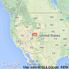
- Duchesne formation
- Modifications:
-
- Original reference
- AAPG geologic province:
-
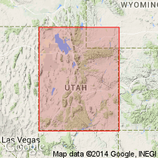
- Uinta basin
Summary:
Pg. 61-63, pl. 1. Duchesne formation. Name proposed (upon suggestion of Prof. W.B. Scott of Princeton Univ.) for the Oligocene formation named "Upper Uinta" by Peterson and Kay in Carnegie Mus. Annals, v. 20, p. 293-305, 1931. This Oligocene horizon, 1,372 feet thick, rests upon Upper Eocene (Horizon C) in Uinta basin. Duchesne River (in Duchesne Co., Utah, which has its source on south side of Uinta Mountains) traverses these Basal Oligocene beds before its confluence with Green River 0.5 mile below Ouray, Utah. The area covered by these Oligocene strata has an east-west extent of approximately 80 miles, and seldom exceeds 12 to 15 miles in north-south direction along north margin of Uinta basin. From Randlette westward, along Duchesne River, these Oligocene beds are quite clearly defined from underlying Uinta series (Horizon C). They consist of sandstones that weather out to reddish brown cliffs, which rest on softer clays (Horizon C of the Uinta) along the streams and on the divides between Lake Fork, "Dry Gulch," Duchesne, and the course of other rivers. Although a tentative division was made by Peterson and Kay between the Duchesne beds and the underlying Uinta strata eastward from Randlette, the distinction between the two horizons is not so clear toward eastern end of basin. The relationship of fauna of Duchesne Oligocene is less sharply defined from that of underlying Uinta (Horizon C) than is usually the case in superimposed horizons of other localities, but there is an advance corresponding to that of the lithological change noted. The Oligocene may thus be regarded as a horizon perfectly transitional between Upper Eocene and Chadron horizon of White River series of South Dakota. But the Sage Creek beds of Montana may have to be placed between the Chadron of Nebraska and Dakota and the Duchesne series of Utah. The Duchesne Oligocene is overlain by talus of Bishop conglomerate.
Source: US geologic names lexicon (USGS Bull. 896, p. 637).

- Usage in publication:
-
- Duchesne River formation
- Modifications:
-
- Revised
- AAPG geologic province:
-
- Uinta basin
Summary:
Pg. 357-359, map, pls. 45, 46. Duchesne River formation. Duchesne formation (proposed by Prof. W.B. Scott) is preoccupied by Keyes' name for a Jurassic limestone. A new name is required for Oligocene formation, but writer feels that there will be less confusion if "Duchesne" is retained in the new term. At Prof. Scott's suggestion the name Duchesne River is now proposed for the lower Oliogocene formation of Uinta basin, Utah. To the south the formation lies conformably on horizon C of Uinta Eocene, but with greater or less unconformity on older rocks along its north border. The formation is divided into 3 named horizons. [For definitions of these 3 horizons see under Randlett horizon.]
Source: US geologic names lexicon (USGS Bull. 896, p. 637).
- Usage in publication:
-
- Duchesne River formation
- Modifications:
-
- Areal extent
- AAPG geologic province:
-
- Uinta basin
Summary:
Pg. 97 (table 1), 99 (table 2), 122-123. Duchesne River formation. Consists of buff and gray sandstone, red and pink sandy shale, and conglomerate; fluviatile. Thickness western part Uinta basin 1,500 feet; eastern part of basin, 1,372 feet. Unconformably underlies Bishop conglomerate; unconformably overlies Uinta and Uinta(?) formation. Age is Oligocene.
Source: US geologic names lexicon (USGS Bull. 1200, p. 1170).
- Usage in publication:
-
- Duchesne River formation*
- Modifications:
-
- Age modified
- Areal extent
- AAPG geologic province:
-
- Uinta basin
- Piceance basin
Summary:
Duchesne River formation. Mapped in oil shale area, Uintah County, Utah, and Rio Blanco County, Colorado. Only basal 50 feet of formation exposed. Along Raven Ridge, unconformably overlies both Uinta formation and Green River formation; near axis of basin, unconformably overlies Uinta formation. Age is Eocene or Oligocene.
Source: US geologic names lexicon (USGS Bull. 1200, p. 1170).
- Usage in publication:
-
- Duchesne River Formation*
- Modifications:
-
- Revised
- AAPG geologic province:
-
- Uinta basin
Summary:
Is unit 3,000 ft thick divisible into four members, the Brennan Basin (new), Dry Gulch Creek (new), Lapoint (formerly called Lapoint horizon of Duchesne River), and Starr Flat (new). Present in northern Uinta basin, northeast UT. Detritus derived from Uinta Mountains. Cross sections. Measured sections. Intertongues with underlying Uinta through an interval 1,064 ft thick. Assigned to the Eocene and possibly Oligocene [age of members not clearly stated]. Date of 39.3 m.y. obtained from ash at Dry Gulch Creek-Lapoint contact. Deposited in a fluvial and lacustrine environment. Fossil identified in Brennan Basin, Dry Gulch Creek, and Lapoint Members.
Source: GNU records (USGS DDS-6; Denver GNULEX).
- Usage in publication:
-
- Duchesne River Formation*
- Modifications:
-
- Geochronologic dating
- Areal extent
- AAPG geologic province:
-
- Uinta basin
Summary:
Divided into four mapped units (geologic map) east of Rock Creek and Duchesne River, Duchesne and Uintah Cos, UT, Uinta basin--Brennan Basin, Dry Gulch Creek, Lapoint, and Starr Flat Members. Is not divided west of Rock Creek and Duchesne River. Interfingers with upper part Uinta Formation north of Duchesne. Interfingers with Green River Formation west of Strawberry Reservoir. Entire Green River grades into alluvial Duchesne River at margin of basin. Duchesne River sediments were deposited by streams flowing south from Uinta Mountains. Age controversial. Fauna, mostly in Lapoint, forms basis for Duchesnean, or of earliest Chadronian, early Oligocene age. Paucity of fossils precludes paleontological dating. Numerous tuff beds (from volcanoes in Wasatch Range, East Tintic, and Oquirrh Mountains to west) provide isotopic ages. Biotite and zircon ages obtained. Some biotite ages are older than those from zircon. Zr ages range from 38.2 +/-1.8 Ma from undivided part to 28.7 +/-2.0 Ma from the Lapoint Member. Brennan Basin is late Eocene and Oligocene. Upper three members are Oligocene. Basal part older in the west. The undivided Duchesne River intertongues with rocks as old as Flagstaff and as young as Starr Flat, and is of Paleocene, Eocene, and Oligocene age.
Source: GNU records (USGS DDS-6; Denver GNULEX).
For more information, please contact Nancy Stamm, Geologic Names Committee Secretary.
Asterisk (*) indicates published by U.S. Geological Survey authors.
"No current usage" (†) implies that a name has been abandoned or has fallen into disuse. Former usage and, if known, replacement name given in parentheses ( ).
Slash (/) indicates name conflicts with nomenclatural guidelines (CSN, 1933; ACSN, 1961, 1970; NACSN, 1983, 2005, 2021). May be explained within brackets ([ ]).