The National Geologic Map Database is migrating to a new infrastructure. We apologize for any service disruptions during this process.
|
|---|


- Usage in publication:
-
- Dubose sands and clays
- Modifications:
-
- Original reference
- Dominant lithology:
-
- Sandstone
- Shale
- AAPG geologic province:
-
- Gulf Coast basin
Summary:
Pg. 1302, 1314, etc. Dubose sands and clays. Series of sands and fossiliferous green and brown shales with beds of volcanic ash and glass, also beds of ashy, peaty shales; numerous septaria and cone-in-cone concretions. One exceptionally definite boulder horizon is exposed on Sandies Creek, Dubose Ranch, Gonzales County, where Catahoula "rice sands" lie unconformably on Dubose zone. Lies stratigraphically above Stone's Switch sand and below Calliham sand, all zones in Whitsett formation as here defined. [Age is Eocene (Jackson).]
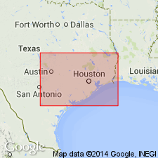
[Present in Gonzales Co., southeastern TX. Named for exposures in valley wall south of Sandies Creek near former Dubose Ranch, 2.5 mi by county road north-northeast of Sample in southern part of Gonzales Co., south-central TX. Sample is on U.S. Highway 87, 7.8 mi south of Smiley (see also Eargle, 1959).]
Source: US geologic names lexicons (USGS Bull. 896, p. 636; USGS Bull. 1200, p. 1168).
- Usage in publication:
-
- Dubose member*
- Modifications:
-
- Revised
- AAPG geologic province:
-
- Gulf Coast basin
Summary:
Pg. 2624 (fig. 1), 2626 (table 1), 2632-2633. Dubose member of Whitsett Formation. Here considered member of Whitsett; overlies Stones Switch member. Near Czestochowa, Karnes County, Texas, about 85 feet of Dubose is exposed; it [overlies] Stones Switch member and unconformably [underlies] Catahoula tuff. Lower 100 feet of member exposed on Tordilla Hill in western Karnes County, hill is capped by sandstone locally called Tordilla sandstone bed; upper part of member is exposed in type section of Whitsett. In southeastern Atascosa County, Texas, and southwest, Dubose conformably [underlies] Calliham sandstone member; northeast of Fashing, Texas, the Calliham is not traceable and Dubose, Calliham sandstone, and Fashing clay member become indistinguishable; northeast of Fashing, this part of section is truncated and overlapped by Catahoula; about 100 feet of Dubose is overlapped in vicinity of Fashing, and about 200 feet is overlapped in northern Karnes County. Age is late Eocene.
Source: US geologic names lexicon (USGS Bull. 1200, p. 1168).
- Usage in publication:
-
- Dubose member*
- Modifications:
-
- Revised
- AAPG geologic province:
-
- Gulf Coast basin
Summary:
Dubose Member of Whitsett Formation of Jackson Group. Rocks previously included as uppermost unit of Dubose Member (Tordilla Sandstone of Eargle, 1959) removed from Dubose, adopted, and raised in rank to Tordilla Sandstone Member of Whitsett Formation. Present in south-central Texas. Age is late Eocene.
Source: Changes in stratigraphic nomenclature, 1972 (USGS Bull. 1394-A, p. A14-A15).

- Usage in publication:
-
- Dubose Member
- Modifications:
-
- Areal extent
- Dominant lithology:
-
- Clay
- Sandstone
- Siltstone
- AAPG geologic province:
-
- Gulf Coast basin
Summary:
Dubose Member of Whitsett Formation. Clay, sandstone, and siltstone; clay, bentonitic, pale yellowish brown; sandstone and siltstone, tuffaceous. Thickness 85 feet. Overlies (grades downward into) Deweesville Sandstone Member of Whitsett; underlies Catahoula Formation (Miocene). Age is considered Eocene and Oligocene(?).
Not separately mapped. [Present in Karnes Co., southeastern TX.]
Source: Modified from GNU records (USGS DDS-6; Denver GNULEX).

- Usage in publication:
-
- Dubose Clay Member
- Modifications:
-
- Areal extent
- AAPG geologic province:
-
- Gulf Coast basin
Summary:
Dubose Clay Member of Whitsett Formation of Jackson Group. Clay, sandstone, and siltstone; clay, bentonitic, pale yellowish brown; sandstone and siltstone, tuffaceous; locally contains oyster banks. Thickness 85 feet. Overlies (grades downward into) Deweesville Sandstone Member and lies below Calliham Sandstone Member (both of Whitsett). Age is Eocene.
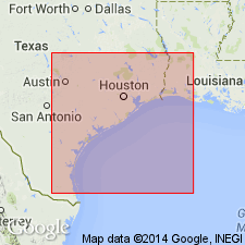
Not separately mapped. [Present in McMullen, Live Oak, Atascosa, and Karnes Cos., southern TX.]
Source: Publication.
For more information, please contact Nancy Stamm, Geologic Names Committee Secretary.
Asterisk (*) indicates published by U.S. Geological Survey authors.
"No current usage" (†) implies that a name has been abandoned or has fallen into disuse. Former usage and, if known, replacement name given in parentheses ( ).
Slash (/) indicates name conflicts with nomenclatural guidelines (CSN, 1933; ACSN, 1961, 1970; NACSN, 1983, 2005, 2021). May be explained within brackets ([ ]).