

- Usage in publication:
-
- Dry Union formation*
- Modifications:
-
- Named
- Dominant lithology:
-
- Ash
- Gravel
- Sand
- Silt
- AAPG geologic province:
-
- Eagle basin
Summary:
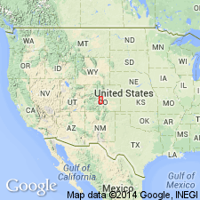
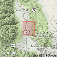
Named for Dry Union Gulch, 5 mi south of Leadville, Lake Co, CO in the Eagle basin. Probably underlies most of the Arkansas Valley from Leadville to Salida (Chaffee Co) in the Eagle basin. No type locality designated. Is a massive. brown, sandy silt and interbedded gravel, sand, and volcanic ash. Is poorly sorted. Consists chiefly of angular grains of fresh rock derived from nearby mountains. Gravel scattered throughout. Deposited chiefly as alluvial fans on a surface of more than 1,000 ft of relief. Channels are numerous. Varies in thickness. Is 260 ft thick near Salida, and may be as much as 2,000 ft thick in the subsurface. Derived from mountains lower than those of today in an arid, cold climate. Vertebrate remains indicate an early Pliocene age.
Source: GNU records (USGS DDS-6; Denver GNULEX).
- Usage in publication:
-
- Dry Union Formation*
- Modifications:
-
- Age modified
- Overview
- Areal extent
- AAPG geologic province:
-
- Eagle basin
Summary:
Exposures in Arkansas valley from Poncha Springs NE quad to Leadville in Eagle basin were compared and assigned to the same stratigraphic unit, the Dry Union Formation. These exposures were given the name Arkansas marl by Hayden (1869). Is chiefly a floodplain and alluvial-fan deposit with source areas to the east, north, and south. Gravels were derived from Precambrian rocks, and from Tertiary Mount Princeton Quartz Monzonite, Nathrop Volcanics and Pando Porphyry. Age changed from Miocene to Miocene and Pliocene on basis of vertebrate fossils (mastodont teeth, toe of a Neohipparion (3-toed horse), camelid, and merycodont). May be equivalent to Wagontongue Formation which also has a 3-toed horse fossil.
Source: GNU records (USGS DDS-6; Denver GNULEX).
For more information, please contact Nancy Stamm, Geologic Names Committee Secretary.
Asterisk (*) indicates published by U.S. Geological Survey authors.
"No current usage" (†) implies that a name has been abandoned or has fallen into disuse. Former usage and, if known, replacement name given in parentheses ( ).
Slash (/) indicates name conflicts with nomenclatural guidelines (CSN, 1933; ACSN, 1961, 1970; NACSN, 1983, 2005, 2021). May be explained within brackets ([ ]).