The National Geologic Map Database is migrating to a new infrastructure. We apologize for any service disruptions during this process.
|
|---|


- Usage in publication:
-
- Dry Lake flow member (informal)
- Modifications:
-
- Original reference
- Dominant lithology:
-
- Pumice
- AAPG geologic province:
-
- Sierra Nevada province
Summary:
Pg. 1453-1464. Dry Lake flow member of Lousetown Formation. Made of many flows that appear to have been extruded over a long interval of time. Cannot be dated relative to most other flows in area, but is older than Hirschdale olivine latite (new), youngest of the Lousetown flows in area. At least 20 flows (or groups of flows) recognized in area. Nine flows (or groups of flows) named and given informal member status in Lousetown Formation. Age is Quaternary.
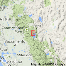
Mapped in vicinity of Dry Lake, Truckee area, north of Lake Tahoe, northeastern CA. [Named from Dry Lake, in sec. 15, T. 17 N., R. 17 E., Truckee 15-min quadrangle, Nevada Co., northeastern CA.]
Source: US geologic names lexicon (USGS Bull. 1350, p. 223); supplemental information from GNU records (USGS DDS-6; Menlo GNULEX).
For more information, please contact Nancy Stamm, Geologic Names Committee Secretary.
Asterisk (*) indicates published by U.S. Geological Survey authors.
"No current usage" (†) implies that a name has been abandoned or has fallen into disuse. Former usage and, if known, replacement name given in parentheses ( ).
Slash (/) indicates name conflicts with nomenclatural guidelines (CSN, 1933; ACSN, 1961, 1970; NACSN, 1983, 2005, 2021). May be explained within brackets ([ ]).