


- Usage in publication:
-
- Dry Hollow latite*
- Modifications:
-
- First used
- Dominant lithology:
-
- Latite
- AAPG geologic province:
-
- Wasatch uplift
Summary:
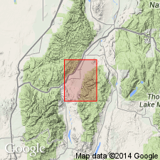
Intent to name and derivation of place name not stated. No type locality designated. Recognized as erosional remnants in the Marysvale region, UT on the Wasatch uplift. Is a brownish-red porphyritic latite and quartz latite. Individual flows are more than 200 ft thick; aggregate thickness probably 1,000 ft. Rests on earlier Tertiary volcanic rocks and on Mount Belknap rhyolite. Is interbedded with Joe Lott tuff. Is overlain by Sevier River formation and by unnamed basalt flows. Assigned a later Tertiary age.
Source: GNU records (USGS DDS-6; Denver GNULEX).
- Usage in publication:
-
- Dry Hollow formation*
- Modifications:
-
- Age modified
- AAPG geologic province:
-
- Wasatch uplift
- Great Basin province
Summary:
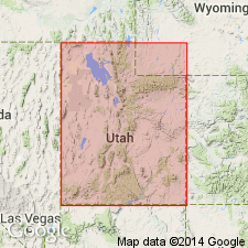
Age changed from Tertiary to Pliocene?. Considered to be the oldest of the Pliocene? units, younger than Bullion Canyon volcanics and older than Joe Lott tuff. Reason for age change other than stratigraphic position not stated. Is widely distributed in Pavant Range, Sevier Plateau, and the low hills east of Joseph. Exposures in quad are in Sevier Co, UT on the Wasatch uplift and in Millard Co, UT in the Great Basin province. Detailed lithologic description. Believed to have erupted from two main centers--one from which the latites erupted and another from which basaltic andesite flows and minor breccia derived.
Source: GNU records (USGS DDS-6; Denver GNULEX).
- Usage in publication:
-
- Dry Hollow Formation
- Modifications:
-
- Revised
- AAPG geologic province:
-
- Wasatch uplift
Summary:
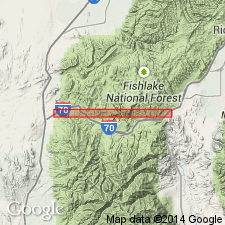
Is a term used in the southern Tushar Mountains, Piute Co, UT on the Wasatch uplift. History of usage. Generally overlies Osiris Tuff, or where Osiris is missing, it rests on the Mount Dutton Formation. Name has been modified since it was first used to include rocks mapped in this report as Osiris (an ash-flow tuff), unnamed basaltic andesitic flows, rocks equal to the Isom Formation, or that belong to the Needles Range Formation. Name is restricted here to only those rocks originally included by Callaghan (1939) in the Dry Hollow--the thick distinctive local flows called red porphyritic latite and gray porphyritic latite by him. Commonly has 40 percent phenocrysts (up to 1 cm long) of feldspar, and lesser amounts of amphibole, biotite, magnetite, pyroxene. The groundmass is partly devitrified glass with numerous aligned feldspar and ferromagnesian microlites. Is at least 350 m thick. Thins south of Tushars. Source vent is probably in Beaver Canyon 19 km east of Beaver, Beaver Co. Assigned to the Miocene based on previously published isotopic ages of 21.7 to 21.8 m.y. Correlation chart; block diagram. Is older than some unnamed basalt flows.
Source: GNU records (USGS DDS-6; Denver GNULEX).
- Usage in publication:
-
- Dry Hollow Formation
- Modifications:
-
- Revised
- AAPG geologic province:
-
- Wasatch uplift
- Great Basin province
Summary:
Defined as following a profound break in volcanic sequence subsequent to deposition of Bullion Canyon Volcanics. Is seldom altered and is never intruded. Two new members defined in lower part--Wales Canyon Tuff Member at base and the overlying Clear Creek Tuff Member. Upper part of Dry Hollow composed of unnamed (listed in ascending order) vitric tuff, lithic tuff, plagioclase ash-flow, and hornblende flow that total between 76 and 200 m thick. Overlies Bullion Canyon Volcanics. Underlies Sevier River Formation. Of Miocene age. Geologic map. Mapped in Millard Co, UT in the Great Basin province and in Sevier Co, UT on the Wasatch uplift.
Source: GNU records (USGS DDS-6; Denver GNULEX).
- Usage in publication:
-
- Dry Hollow Formation†
- Modifications:
-
- Abandoned
Summary:
Similarity between some phenocryst-rich rocks in the northern part of the Marysvale volcanic pile and some thick local quartz latite lava flows in the southern part of the pile has resulted in erroneous correlations. Some have thought the Dry Hollow underlies the Osiris Tuff; others thought it was younger than the Osiris. Rocks in Clear Creek area, Beaver Co. are included now in the Three Creeks Tuff Member of Bullion Canyon Volcanics. Remainder of Dry Hollow is equivalent to Bullion Canyon. Name has little utility and is abandoned.
Source: GNU records (USGS DDS-6; Denver GNULEX).
For more information, please contact Nancy Stamm, Geologic Names Committee Secretary.
Asterisk (*) indicates published by U.S. Geological Survey authors.
"No current usage" (†) implies that a name has been abandoned or has fallen into disuse. Former usage and, if known, replacement name given in parentheses ( ).
Slash (/) indicates name conflicts with nomenclatural guidelines (CSN, 1933; ACSN, 1961, 1970; NACSN, 1983, 2005, 2021). May be explained within brackets ([ ]).