

- Usage in publication:
-
- Dry Camp breccia
- Modifications:
-
- Original reference
- Dominant lithology:
-
- Breccia
- AAPG geologic province:
-
- Plateau sedimentary province
Summary:
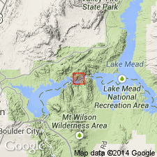
Pg. 99, fig. 34 (geol. map). Dry Camp breccia. An intervolcanic sedimentary breccia. Resembles Dam breccia (new) but more definitely bedded. Maximum thickness about 400 feet. Part of younger volcanic series of area. Underlain and overlain by basalt. Name credited to F.L. Ransome (unpub. report). Age is Tertiary.
Occurs only on east side of Black Canyon, Hoover Dam area, northwestern AZ.
Source: US geologic names lexicon (USGS Bull. 1200, p. 1162).

- Usage in publication:
-
- McClearys Bluff coal member*
- Modifications:
-
- Original reference
- AAPG geologic province:
-
- Illinois basin
Summary:
Pg. 40, 51 (table 1), 82, pl. 1. McClearys Bluff coal member of Mattoon formation of McLeansboro group. Name applied to 3-inch coal bed that lies an estimated 50 feet above Friendsville coal member. Occurs in central and southeastern Illinois. Age is Pennsylvanian. Presentation of new rock-stratigraphic classification of Pennsylvanian of Illinois. Cyclical classification retained but is entirely independent of rock-stratigraphic classification.
Type locality: in NW/4 SW/4 SE/4 sec. 29, T. 2 S., R. 13 W., Wabash Co., southeastern IL. Named from McClearys Bluff.
Source: US geologic names lexicon (USGS Bull. 1200, p. 2290).
For more information, please contact Nancy Stamm, Geologic Names Committee Secretary.
Asterisk (*) indicates published by U.S. Geological Survey authors.
"No current usage" (†) implies that a name has been abandoned or has fallen into disuse. Former usage and, if known, replacement name given in parentheses ( ).
Slash (/) indicates name conflicts with nomenclatural guidelines (CSN, 1933; ACSN, 1961, 1970; NACSN, 1983, 2005, 2021). May be explained within brackets ([ ]).