The National Geologic Map Database is migrating to a new infrastructure. We apologize for any service disruptions during this process.
|
|---|


- Usage in publication:
-
- Drumlummon porphyry*
- Modifications:
-
- First used
- Dominant lithology:
-
- Porphyry
- AAPG geologic province:
-
- Montana folded belt
Summary:
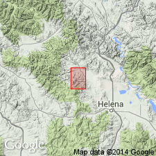
First used as a name for some porphyry dikes within the margin of the Marysville batholith. No type locality designated. Probably named for Drumlummon Hill southeast of Marysville, Lewis and Clark Co, MT in the Montana folded belt province. Also occurs in the Drumlummon mine. Is spotted with numerous small phenocrysts, not over one-eighth inch in diameter. of feldspar. The matrix is brown-white. Phenocrysts not visible at all locations due to alteration. Is predominately plagioclase feldspar. Though younger than the batholith, they are probably related to it. Tertiary in age.
Source: GNU records (USGS DDS-6; Denver GNULEX).
For more information, please contact Nancy Stamm, Geologic Names Committee Secretary.
Asterisk (*) indicates published by U.S. Geological Survey authors.
"No current usage" (†) implies that a name has been abandoned or has fallen into disuse. Former usage and, if known, replacement name given in parentheses ( ).
Slash (/) indicates name conflicts with nomenclatural guidelines (CSN, 1933; ACSN, 1961, 1970; NACSN, 1983, 2005, 2021). May be explained within brackets ([ ]).