

- Usage in publication:
-
- Drum limestone*
- Modifications:
-
- Original reference
- Dominant lithology:
-
- Limestone
- AAPG geologic province:
-
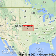
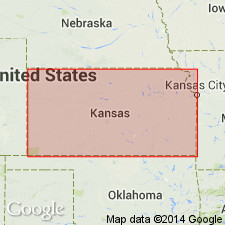
- Cherokee basin
Summary:
Pg. 37, 63, 66. Drum limestone. Fossiliferous limestone, 25 to 40 feet thick, overlying Cherryvale shale and underlying Chanute shale. Previously called Independence limestone (Haworth and Platt, 1894; Adams, 1896). Age is late Carboniferous (Pennsylvanian). Report includes fossil list, geologic maps.
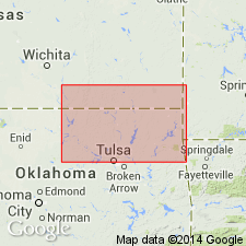
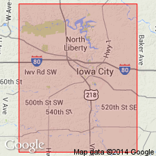
Named from Drum Creek, Montgomery Co., southeastern KS.
Source: US geologic names lexicon (USGS Bull. 896, p. 633-634); supplemental information from GNU records (USGS DDS-6; Denver GNULEX).

- Usage in publication:
-
- Drum limestone*
- Drum limestone member*
- Drum group†
- Modifications:
-
- Overview
Summary:
Drum limestone of Kansas City group (Kansas); Drum limestone member of Kansas City formation (Missouri). In Kansas the Kansas City is treated as a group and the Drum as a formation. The terms "Drum group" and "Drum limestone" have been used in central northern Oklahoma to include (descending) Dewey limestone, Nellie Bly formation, and Hogshooter limestone, but that usage has been discontinued.
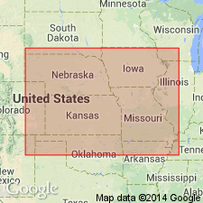
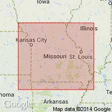
The Drum limestone of Hinds and Greene (1915 report) at Kansas City is now stated (N.D. Newell, Kansas Geol. Survey Bull., no. 21, 1935, p. 40, and R.C. Moore, Kansas Geol. Survey Bull., no. 22, 1936, p. 104-105) to be an oler limestone, the type Westerville. The Cherryvale shale has been subdivided by R.C. Moore into 5 members, the upper one of which he has named Quivira shale. The true Drum is now divided by Kansas Geol. Survey (R.C. Moore, Bull. 22, 1936) into 2 members, Corbin City limestone (oolitic) above and Cement City limestone (nonoolitic) below. According to Newell (1935) these 2 members are unconformable. R.C. Moore states (Bull. 22, 1936) Drum is 2 to 60 feet thick, has been traced from Oklahoma line to Kansas City, and has been identified at various places in [northwestern Missouri, southwestern Iowa, southeastern Nebraska, eastern Kansas]. Age is Pennsylvanian.
Source: US geologic names lexicon (USGS Bull. 896, p. 633-634).
- Usage in publication:
-
- Drum limestone
- Modifications:
-
- Areal extent
Summary:
Pg. 40 (table), 42. Drum limestone. Included in Skiatook group. Overlies Cherryvale shale; underlies Chanute shale of Ochelata group. Near Kansas-Oklahoma State line, the Drum is absent owing to erosion. Reappears a few miles osuth of State line and in Oklahoma has been known as Dewey limestone.
Source: US geologic names lexicon (USGS Bull. 1200, p. 1160-1161).
- Usage in publication:
-
- Drum limestone
- Modifications:
-
- Revised
Summary:
Pg. 2030-2032. Drum limestone, in type area, comprises two units classed as members. Upper unit, Corbin City, locally 40 feet or more in thickness, is not persistent. Corbin City disconformably overlies lower member which consists of fine-grained bluish limestone; this is identified unquestionably as Dewey limestone of northeastern Oklahoma. Northeastward tracing proves that Dewey member is same as limestone called Cement City in Kansas City area. Inasmuch as Dewey has priority over Cement City and has been widely used, it is recognized by Oklahoma Geological Survey as formational unit which is classed as uppermost division of Skiatook group. Kansas has used Cement City for lower member of Drum limestone, and Cement City was recognized by interstate conference. Kansas proposes to deviate from interstate classification by adopting Dewey, instead of Cement City. Age is Late Pennsylvanian (Missourian).
Source: US geologic names lexicon (USGS Bull. 1200, p. 1160-1161).
- Usage in publication:
-
- Drum formation
- Modifications:
-
- Principal reference
- Revised
- AAPG geologic province:
-
- Salina basin
- Cherokee basin
Summary:
Pg. 36-37. Drum formation. Comprises (ascending) Corbin City limestone (missing in Nebraska), Cement City limestone, Richfield Quarry shale (new), and P.W.A. Quarry limestone (new) members. Thicknesses: 12.5 feet southwestern Iowa; 14 feet, Sarpy County, Nebraska; 3 to 18 feet, Kansas City, Missouri; 2 to 60 feet in Kansas. Underlies Chanute formation; overlies Quivira formation. Note on type locality.
Type locality: along highway east of Independence, Kansas, and at cement plant in northwestern part sec. 4, T. 33 S., R. 16 E. Named from Drum Creek, Montgomery Co., KS.
Source: US geologic names lexicon (USGS Bull. 1200, p. 1160-1161).
- Usage in publication:
-
- Drum formation
- Modifications:
-
- Areal extent
- AAPG geologic province:
-
- Iowa shelf
- Forest City basin
Summary:
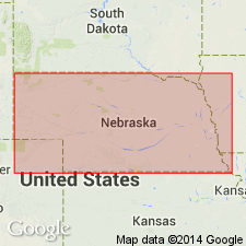
Pg. 418 (fig. 1), 420. Drum formation. Thickness of formation 2 feet in Madison and Adair Counties, Iowa; no members differentiated. Overlies Cherryvale formation; underlies Chanute formation. In Kansas City group. Age is Late Pennsylvanian (Missourian).
Source: US geologic names lexicon (USGS Bull. 1200, p. 1160-1161).
- Usage in publication:
-
- Drum limestone*
- Modifications:
-
- Overview
Summary:
As shown on chart, Drum limestone comprises (ascending) Cement City limestone and Corbin City limestone members. Age is Pennsylvanian (Missourian).
Source: US geologic names lexicon (USGS Bull. 1200, p. 1160-1161).

- Usage in publication:
-
- Drum formation
- Modifications:
-
- Areal extent
- AAPG geologic province:
-
- Iowa shelf
- Forest City basin
Summary:
Pg. 26, fig. 5. Drum formation of Kansas City group. In Iowa is single conglomeratic, oolitic limestone bed characterized by tiny TRITICITES. Thickness 6 feet, Madison County; 14 feet, Pottawattamie County. Overlies Quivira shale; underlies Chanute shale. Age is Late Pennsylvanian (Missourian).
Source: US geologic names lexicon (USGS Bull. 1200, p. 1160-1161).
- Usage in publication:
-
- Drum Formation
- Drum Limestone
- Modifications:
-
- Not used
- AAPG geologic province:
-
- Forest City basin
Summary:
Pg. C387. Drum Formation (Drum Limestone). Heckel and Watney (2002, p. 29) indicate that the type section for the Drum Limestone is actually a southern Kansas correlative of the Westerville Limestone Member of the Cherryvale Formation, and they included it as the upper member of the Cherryvale Formation in southeastern Kansas. It appears that the Drum, as defined from its type section, is not even present in Missouri. The former constituents of the "Drum Formation," the Cement City Limestone Member and Corbin City Limestone Member, are both now regarded to comprise the upper member (Cement City Limestone Member) of the Dewey Formation.
Source: Publication.
For more information, please contact Nancy Stamm, Geologic Names Committee Secretary.
Asterisk (*) indicates published by U.S. Geological Survey authors.
"No current usage" (†) implies that a name has been abandoned or has fallen into disuse. Former usage and, if known, replacement name given in parentheses ( ).
Slash (/) indicates name conflicts with nomenclatural guidelines (CSN, 1933; ACSN, 1961, 1970; NACSN, 1983, 2005, 2021). May be explained within brackets ([ ]).