The National Geologic Map Database is migrating to a new infrastructure. We apologize for any service disruptions during this process.
|
|---|


- Usage in publication:
-
- Drewsey Formation*
- Modifications:
-
- Named
- Dominant lithology:
-
- Tuff
- Agglomerates
- Sandstone
- AAPG geologic province:
-
- Southern Oregon basin
Summary:
Pg. 23 (map 5), 28-31, 32 (fig. 7). Drewsey Formation. Predominantly rhyolitic pumice tuff, agglomeratic mudflows, agglomerates, gravels, grits, sands, silts, tuffs, cinders, volcanic ashes, and basalt flows. No single section includes all the lithologies. Roughly, formation includes (ascending) welded tuff member, tuff agglomerate member, and tuff and sandstone member. Thickness as much as 1,050 feet; 1,000 feet at type section. Unconformably overlies Juntura formation (new); underlies Drinkwater basalt (new). Age is Pliocene (Hemphillian mammalian fauna).
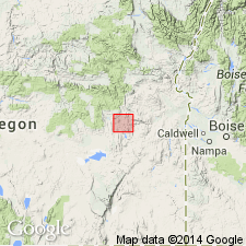
Type section: exposures in Table Mountain just north of town of Drewsey, Harney Co., and directly across Malheur River, southeastern OR. Formation lies mainly within northwest-southeast trending syncline that passes east of town of Drewsey and along west flank of Drinkwater Mountain.
Source: US geologic names lexicon (USGS Bull. 1350, p. 221-222).
For more information, please contact Nancy Stamm, Geologic Names Committee Secretary.
Asterisk (*) indicates published by U.S. Geological Survey authors.
"No current usage" (†) implies that a name has been abandoned or has fallen into disuse. Former usage and, if known, replacement name given in parentheses ( ).
Slash (/) indicates name conflicts with nomenclatural guidelines (CSN, 1933; ACSN, 1961, 1970; NACSN, 1983, 2005, 2021). May be explained within brackets ([ ]).