- Usage in publication:
-
- Draytonville conglomerate member*
- Modifications:
-
- Original reference
- Dominant lithology:
-
- Conglomerate
- AAPG geologic province:
-
- Piedmont-Blue Ridge province
Summary:
Draytonville conglomerate member of Kings Mountain quartzite. Hard, heavy-bedded conglomerate, now almost a gneiss. Thickness 25 to 50 feet. Basal member of Kings Mountain quartzite. Age is Cambrian (probably Early).
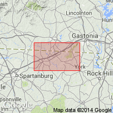
[Named from exposures on Draytonville Mountain, Cherokee Co., northwestern SC. Extends into southern NC.]
Source: US geologic names lexicon (USGS Bull. 896, p. 631).

- Usage in publication:
-
- Draytonville conglomerate member*
Summary:
Draytonville conglomerate member of Kings Mountain quartzite. The USGS currently [ca. 1960] designates the age of Draytonville as Ordovician to Mississippian on the basis of a study now in progress. [See Overstreet and Bell (1965).] Recognized in northwestern South Carolina and southern North Carolina.
Source: US geologic names lexicon (USGS Bull. 1200, p. 1156).

- Usage in publication:
-
- Draytonville Conglomerate Member*
- Modifications:
-
- Age modified
- AAPG geologic province:
-
- Piedmont-Blue Ridge province
Summary:
Pg. 51, 89 (geol. time scale), 109. Draytonville Conglomerate Member of Kings Mountain Quartzite. Age changed from Cambrian --to-- Ordovician to Mississippian. (Authors follow revised time scale of Holmes, 1959, Edinburgh Geol. Soc. Trans., v. 17, pt. 3, p. 183-216.)
Source: Publication; Changes in stratigraphic nomenclature, 1964 (USGS Bull. 1224-A, p. A17).

- Usage in publication:
-
- Draytonville Metaconglomerate Member*
- Modifications:
-
- Revised
- AAPG geologic province:
-
- Piedmont-Blue Ridge province
Summary:
Battleground Schist redefined as Battleground Formation and revised to include metavolcanic and metasedimentary rocks previously mapped as Bessemer Granite, and interlayered units previously mapped as Kins Mountain Quartzite (both names abandoned in this report). Upper and lower contacts not known to be exposed. Includes four members in descending order: Crowders Creek Metaconglomerate Member (new), Draytonville Metaconglomerate Member (revised and redefined), Jumping Branch Manganiferous Member (new) and Dixon Gap Metaconglomerate Member (new). Late Proterozoic age is inferred on the basis of U-Pb isotope data from zircons in metatonalite plutons in the lower part of the Battleground Formation. The Draytonville is restricted to quartz-pebble-metaconglomerate beds that can be correlated with exposures at type locality on Draytonville Mountain. Described as "bed D" by France and Brown (1981: Carolina Geol. Soc. Guidebook, October, p. 91-99). [As described by Keith and Sterrett (1931), Draytonville originally included beds C, D, and E according to France and Brown.]
Source: GNU records (USGS DDS-6; Reston GNULEX).
For more information, please contact Nancy Stamm, Geologic Names Committee Secretary.
Asterisk (*) indicates published by U.S. Geological Survey authors.
"No current usage" (†) implies that a name has been abandoned or has fallen into disuse. Former usage and, if known, replacement name given in parentheses ( ).
Slash (/) indicates name conflicts with nomenclatural guidelines (CSN, 1933; ACSN, 1961, 1970; NACSN, 1983, 2005, 2021). May be explained within brackets ([ ]).

