

- Usage in publication:
-
- Doyle shale*
- Modifications:
-
- Original reference
- Dominant lithology:
-
- Shale
- Limestone
- AAPG geologic province:
-
- Sedgwick basin
Summary:
Pg. 715. Doyle shale in Chase stage. Variously colored shales, 60 feet thick, including a few thin beds of soft limestone. Overlies Fort Riley limestone and underlies Winfield formation, which includes (descending) Winfield concretionary limestone; yellowish shales; and cherty limestone ("Marion flint"). Age is Permian (of Prosser and Frech). [This definition of Doyle shale was followed until 1929.]
Source: US geologic names lexicon (USGS Bull. 896, p. 629); GNC KS-NE Permian Corr. Chart, Oct. 1936.
- Usage in publication:
-
- Doyle shale
- Modifications:
-
- Revised
- AAPG geologic province:
-
- Nemaha anticline
Summary:
Doyle shale. Included in Doyle shale in Cowley County, eastern Kansas, all beds below top member (called Winfield concretionary limestone in early reports) of Prosser's Winfield formation and above Fort Riley limestone. Age is Permian.
Source: US geologic names lexicon (USGS Bull. 896, p. 629).

- Usage in publication:
-
- Doyle formation
- Modifications:
-
- Revised
- AAPG geologic province:
-
- Nemaha anticline
Summary:
Doyle formation of Chase group. Divided Doyle shale of Prosser into 3 members (descending) Gage shale, Towanda limestone, and Holmesville shale, aggregating 66 feet in thickness, and divided overlying Winfield [formation], also of Chase group, into 3 members (descending): Cresswell limestone (called "concretionary" limestone in previous reports), Grant shale, and Stovall limestone. Age is Permian (Big Blue).
Source: US geologic names lexicon (USGS Bull. 896, p. 629); GNC KS-NE Permian Corr. Chart, Oct. 1936.
- Usage in publication:
-
- Doyle shale†
- Modifications:
-
- Abandoned
Summary:
Pg. 12. Dropped Doyle shale and recognized Condra's 1931 members (ascending, Holmesville shale, Towanda limestone, and Gage shale) as formations.
Source: US geologic names lexicon (USGS Bull. 896, p. 629); GNC KS-NE Permian Corr. Chart, Oct. 1936.

- Usage in publication:
-
- Doyle shale*
- Modifications:
-
- Overview
Summary:
These recent reports [1929-1936] (which apparently follow Prosser's definitions of Doyle and Winfield) have not been considered by the USGS for its publications.
Source: US geologic names lexicon (USGS Bull. 896, p. 629).
- Usage in publication:
-
- Doyle shale
- Modifications:
-
- Reinstated
Summary:
Pg. 80. Doyle shale of Chase group. Restored to formal nomenclature and considered as consisting of (ascending) Holmesville shale, Towanda limestone, and Gage shale members, which had heretofore been given formational rank. Overlies Barneston limestone; underlies Winfield limestone. Age is Permian.
Source: US geologic names lexicon (USGS Bull. 1200, p. 1153).
- Usage in publication:
-
- Doyle shale*
- Modifications:
-
- Areal extent
- AAPG geologic province:
-
- Chautauqua platform
Summary:
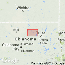
Pg. 115-116. Doyle shale of Chase group. Subdivided into (ascending) Holmesville shale, Towanda limestone, and Gage shale members. Members recognized in Kansas, southeastern Nebraska, and northern Oklahoma where they have been identified in Kay and Osage Counties. Members cannot be differentiated in Pawnee County. Thickness 103 to 118 feet in Kay County; 125 to 135 feet in Osage County. Thickness difficult to determine in Pawnee County; electric logs show about 150 feet. Overlies Fort Riley limestone; underlies Winfield limestone. Age is Early Permian (Wolfcamp).
Source: US geologic names lexicon (USGS Bull. 1200, p. 1153).
For more information, please contact Nancy Stamm, Geologic Names Committee Secretary.
Asterisk (*) indicates published by U.S. Geological Survey authors.
"No current usage" (†) implies that a name has been abandoned or has fallen into disuse. Former usage and, if known, replacement name given in parentheses ( ).
Slash (/) indicates name conflicts with nomenclatural guidelines (CSN, 1933; ACSN, 1961, 1970; NACSN, 1983, 2005, 2021). May be explained within brackets ([ ]).