The National Geologic Map Database is migrating to a new infrastructure. We apologize for any service disruptions during this process.
|
|---|


- Usage in publication:
-
- Doyle Creek Formation
- Modifications:
-
- Named
- Dominant lithology:
-
- Volcaniclastics
- AAPG geologic province:
-
- Blue Mountains province
- Snake River basin
Summary:
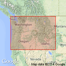
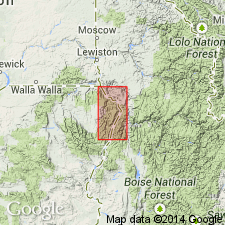
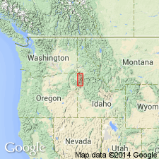
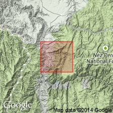
Includes two members (both new): Ashby Creek Conglomerate and Piedmont Point. Conformably overlies Grassy Ridge Formation (new). May interfinger with Imnaha Formation (new) east of Fish Lake. Conformably underlies Martin Bridge Formation. Mapped in area between Wallowa Mountains of northeastern OR and Seven Devils Mountains of western ID (part of Snake River Canyon is included). Is Late Triassic (Karnian) age.
[Type section in on north side of Doyle Creek from Snake River to elevation of 3,850 ft, Wallowa Co, OR. Is sequence of red and green flow rocks and volcaniclastic rocks exposed in Snake River Canyon, Imnaha River Canyon, and in valleys of Elk Creek and Duck Creek.]
Source: GNU records (USGS DDS-6; Menlo GNULEX).
- Usage in publication:
-
- Doyle Creek Formation
- Modifications:
-
- Revised
- AAPG geologic province:
-
- Blue Mountains province
- Snake River basin
Summary:
Mapped as uppermost member of Seven Devils Group in Snake River Canyon, Oregon and Idaho. Described as maroon and green volcanic breccia, metabasalt and keratophyre, volcanic sandstone and shale, tuff, and thin metabasalt flows. Thin limestone beds are exposed only at Pittsburg Landing. Is laterally equivalent to Pittsburg Formation. Unconformably(?) underlies Martin Bridge Formation. Unconformably(?) overlies Wild Sheep Formation. Age is Late Triassic (Karnian), on basis of stratigraphic relations.
Source: GNU records (USGS DDS-6; Menlo GNULEX).
- Usage in publication:
-
- Doyle Creek Formation*
- Modifications:
-
- Named
- Reference
- Dominant lithology:
-
- Basalt
- Andesite
- Dacite
- Breccia
- AAPG geologic province:
-
- Eastern Columbia basin
- Idaho Mountains province
- Blue Mountains province
Summary:
Pg. 10 (fig. 3), 36-48, 55 (fig. 12). Doyle Creek Formation, uppermost of 4 formations of Seven Devils Group (revised). Formally named herein for thick section of red and green metamorphosed volcaniclastic rocks and volcanic flow rocks that are well exposed in Doyle Creek, first major creek north of Big Bar, on Oregon side of Snake River. Flow rocks are mostly porphyritic and coarsely porphyritic metamorphosed basalt, basaltic andesite, andesite, and dacite. Volcaniclastic rocks are about 50 percent pyroclastic breccia and tuff. Present locally are conglomerates of flow rocks, volcanic breccia, and sandstone that are usually poorly sorted with angular to well-rounded clasts ranging from 0.5 to 10 cm in diameter. Thickness is about 500 m; is 301 m at type section and 186 m at McGraw Creek. Is exposed discontinuously, mostly along Oregon side of Snake River between Ashby and Saddle Creeks, Pittsburg Landing, and near Cook Creek. Includes Kurry Creek Member (new) in upper part. Overlies Wild Sheep Formation (of Seven Devils Group); is distinguished from Wild Sheep by red color and abundance of epiclastic rocks. At Doyle Creek, contact is placed at base of first thick red epiclastic volcanic breccia. At McGraw Creek unconformably(?) underlies Martin Limestone; at type section and reference section, near Ashby Creek, underlies Columbia River Basalt Group. Age is Late Triassic (Karnian and possibly early Norian). Report includes modal and chemical analyses, measured sections, stratigraphic column, geologic map. [Doyle Creek Formation adopted by the USGS. (First introduced by Vallier, 1967.)]
Named from Doyle Creek, Wallowa Co., OR (Eastern Columbia basin).
Type section: measured along north side of the south fork of Doyle Creek from 2,800 to 3,600 ft (855 to 1,000 m) elevation in unsurveyed part of Snake River Canyon, across river from center sec. 17, T. 21 N., R. 3 W., Cuprum 15-min quadrangle, Wallowa Co., OR. Contact with Snake River Basalt at 3,600 ft (1,000 m).
Reference sections: (1) measured along north side of McGraw Creek beginning 50 m above creek bed, from 2,200 to 2,800 ft (670 to 855 m) elevation in unsurveyed part of Snake River Canyon, Homestead 15-min quadrangle, Wallowa Co., OR (mouth of McGraw Creek is across river from N/2 sec. 1, T. 20 N., R. 4 W., in ID), contact with Martin Bridge Limestone at 2,800 ft (855 m); and (2) measured along the second gully north of Ashby Creek between 3,100 and 3,700 ft (945 and 1,130 m) elevation, in SW/4 NE/4 sec. 2, T. 6 S., R. 48 E., Homestead 15-min quadrangle, Baker Co., OR.
Source: Publication; GNU records (USGS DDS-6; Denver GNULEX, Meno GNULEX); Changes in stratigraphic nomenclature, 1977 (USGS Bull. 1457-A, p. A24).
- Usage in publication:
-
- Doyle Creek Formation*
- Modifications:
-
- Areal extent
- AAPG geologic province:
-
- Idaho Mountains province
Summary:
Doyle Creek Formation of Seven Devils Group. Mapped as part of Wallowa terrane, in Idaho County, Idaho (Idaho Mountains province). In small area on east side of Salmon River, Seven Devils Group divisible into: (1) Hunsaker Creek or Windy Ridge Formation; and (2) Doyle Creek Formation; group is not divisible on west side of Salmon River. Doyle Creek Formation, where recognizable, is a green and maroon metavolcanic and interlayered volcaniclastic unit; is dominantly muscovite-chlorite schist. Has layers (up to 50 m thick) of fine- to medium-grained marble and calcareous phyllite, and layers (up to 20 m thick) of volcaniclastic conglomerate with clasts of weakly schistose, stretched, multi-lithologic volcanic and volcaniclastic rocks. Top is gradational with overlying Martin Bridge Formation (revised, redescribed). Base not exposed due to faulting. Age is Late Triassic.
Source: Modified from GNU records (USGS DDS-6; Denver GNULEX).
- Usage in publication:
-
- Doyle Creek Formation*
- Modifications:
-
- Revised
- AAPG geologic province:
-
- Blue Mountains province
- Snake River basin
Summary:
Owing to the abandonment of its Kurry Creek Member, Doyle Creek Formation is restricted from (part of) Kurry Creek area (Pittsburg Landing vicinity). These strata are reassigned to overlying Coon Hollow Formation.
Source: GNU records (USGS DDS-6; Menlo GNULEX).
- Usage in publication:
-
- Doyle Creek Formation*
- Modifications:
-
- Age modified
- AAPG geologic province:
-
- Blue Mountains province
Summary:
Age of the Doyle Creek Formation is revised from Late Triassic --to-- Middle and Late Triassic based on the presence of fossils.
Source: GNU records (USGS DDS-6; Menlo GNULEX).
For more information, please contact Nancy Stamm, Geologic Names Committee Secretary.
Asterisk (*) indicates published by U.S. Geological Survey authors.
"No current usage" (†) implies that a name has been abandoned or has fallen into disuse. Former usage and, if known, replacement name given in parentheses ( ).
Slash (/) indicates name conflicts with nomenclatural guidelines (CSN, 1933; ACSN, 1961, 1970; NACSN, 1983, 2005, 2021). May be explained within brackets ([ ]).