The National Geologic Map Database is migrating to a new infrastructure. We apologize for any service disruptions during this process.
|
|---|


- Usage in publication:
-
- Dothan formation*
- Modifications:
-
- Original reference
- AAPG geologic province:
-
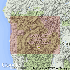
- Western Columbia basin
Summary:
Pg. 401-421. Dothan formation. Chiefly sandstone, with much interbedded dark shale. Jurassic fossils. Lies unconformably below the Knoxville (Myrtle formation), and with its occasional beds of chert writer believes it is = in part the Franciscan of California. Named from Dothan Post Office, on Cow Creek. [Table puts Dothan formation above Galice formation, but p. 421 says Dothan underlies Galice.]
Source: US geologic names lexicon (USGS Bull. 896, p. 624).
- Usage in publication:
-
- Dothan formation*
- Modifications:
-
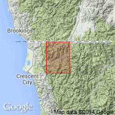
- Areal extent
Summary:
Pg. 17-18. Dothan formation. Jurassic sedimentary rocks of Galice-Kerby-Waldo region consists of 2 formations --Galice formation on southeast and Dothan formation on northwest, separated by an irregular belt of igneous rocks, mainly greenstone and serpentine. Relative position indicates Dothan formation is younger than Galice. The Cretaceous is markedly unconformable on Jurassic.
Source: US geologic names lexicon (USGS Bull. 896, p. 624).
- Usage in publication:
-
- Dothan formation*
- Modifications:
-
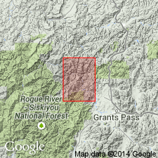
- Areal extent
Summary:
Thickness of Dothan formation is 1,000 to 6,000 feet. Knoxville and Horsetown formations overlap Dothan formation. Is thought to be = Franciscan formation of California.
Source: US geologic names lexicon (USGS Bull. 896, p. 624).
- Usage in publication:
-
- Dothan formation*
- Modifications:
-
- Revised
Summary:
Pg. 81-83. Dothan formation. Diller (1907) concluded that the Dothan was younger than the Galice and believed that the entire section, Galice, volcanics, and Dothan, was overturned. Present study indicates that Dothan sediments in type section are not overturned, except locally on drag folds; Dothan is older than the Galice and, at type section at least, is separated from it by volcanics which grade downward into the former and upward into the latter. Age is Late Jurassic.
Source: US geologic names lexicon (USGS Bull. 1200, p. 1144-1145).
- Usage in publication:
-
- Dothan formation*
- Modifications:
-
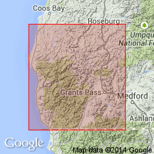
- Areal extent
Summary:
Pg. 84-86, pl. 11. Dothan formation. Geographically extended into Gasquet quadrangle, California, where it consists of about 15,000 feet of graywacke, sandstone, shale, chert, and conglomerate. In northwest corner of quadrangle, Dothan rocks plunge southward under, and are generally conformable with, the peridotite sheet of Josephine Mountains; to the south, on Middle Fork of Smith River, the peridotite in turn underlies southward-plunging metavolcanic rocks of Galice formation that are known to be in normal position; hence, it is assumed Dothan underlies Galice, and although older than Galice, is still probably no older than Late Jurassic.
Source: US geologic names lexicon (USGS Bull. 1200, p. 1144-1145).
- Usage in publication:
-
- Dothan formation*
- Modifications:
-
- Revised
Summary:
Dothan formation. Consists largely of sandstone, siltstone, and shale, with a few chert lenses, lenticular beds of conglomerate, and layers of volcanic rocks. Crops out in western part of quadrangle; distance across strike is 12 miles, 7 within and 5 without the quadrangle. Thickness difficult to determine due to thickening by folding and repetition of beds; stratigraphic thickness may be 10,000 to 18,000 feet. Present study shows Dothan is right side up and stratigraphically below volcanic rocks of Rogue formation (new). Dothan is assumed to be older than Galice. Age is Late Jurassic.
Source: US geologic names lexicon (USGS Bull. 1200, p. 1144-1145).
- Usage in publication:
-
- Dothan formation*
- AAPG geologic province:
-
- Western Columbia basin
Summary:
Pg. 2778. Dothan formation. Myrtle formation in southwestern Oregon is herein rank raised to group and subdivided into Riddle and Days Creek formations. Some of Myrtle formation as mapped by Diller is excluded from Myrtle group and reassigned to Dothan formation. Riddle formation rests on Rogue formation near Days Creek and in valley of Myrtle Creek, Douglas County; on Dothan formation in Dutchman Foggy Creek area of Bone Mountain quadrangle in Coos County. Contact with these underlying formations is angular unconformity. Age is Late Jurassic.
Source: US geologic names lexicon (USGS Bull. 1200, p. 1144-1145).
For more information, please contact Nancy Stamm, Geologic Names Committee Secretary.
Asterisk (*) indicates published by U.S. Geological Survey authors.
"No current usage" (†) implies that a name has been abandoned or has fallen into disuse. Former usage and, if known, replacement name given in parentheses ( ).
Slash (/) indicates name conflicts with nomenclatural guidelines (CSN, 1933; ACSN, 1961, 1970; NACSN, 1983, 2005, 2021). May be explained within brackets ([ ]).