

- Usage in publication:
-
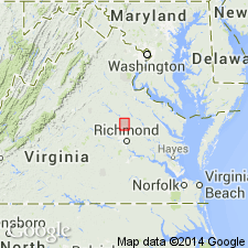
- Doswell Formation*
- Modifications:
-
- Named
- Dominant lithology:
-
- Sandstone
- Conglomerate
- Siltstone
- Coal
- AAPG geologic province:
-
- Taylorsville basin
- Piedmont-Blue Ridge province
Summary:
The Doswell Formation of the Newark Group, here named for the village of Doswell, Hanover Co., VA, consists of sandstone, conglomerate, and siltstone with minor shale, limestone, and coal. Coal measures are confined to an interval from 800-2000 ft (244-610 m) above the base, which is the basis for dividing the formation into three members, the Stagg Creek, Falling Creek, and Newfound Members. The Doswell nonconformably overlies Mississippian Petersburg Granite and unconformably underlies Miocene to Holocene unconsolidated strata. Thickness is 4800 ft (1450 m) at the type section. Age is Late Triassic (middle and late Carnian).
Source: GNU records (USGS DDS-6; Reston GNULEX).
For more information, please contact Nancy Stamm, Geologic Names Committee Secretary.
Asterisk (*) indicates published by U.S. Geological Survey authors.
"No current usage" (†) implies that a name has been abandoned or has fallen into disuse. Former usage and, if known, replacement name given in parentheses ( ).
Slash (/) indicates name conflicts with nomenclatural guidelines (CSN, 1933; ACSN, 1961, 1970; NACSN, 1983, 2005, 2021). May be explained within brackets ([ ]).