

- Usage in publication:
-
- Dos Alamos gypsum member*
- Modifications:
-
- Original reference
- Dominant lithology:
-
- Gypsum
- AAPG geologic province:
-
- Permian basin
Summary:
Pg. 922, 925. Dos Alamos gypsum member of Delaware Mountain formation. Near base of Delaware Mountain formation is a thin bed of gypsum for which name Dos Alamos gypsum is suggested. The gypsum member suggests retreat and readvance of the seas, and thus confirms existence of an unconformity at base of Delaware Mountain sandstone. Age is Permian. [Dos Alamos gypusm member of Delaware Mountain formation adopted by the USGS. Recognized only in Sierra Diablo, western Texas.]
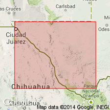
Named from exposures near Dos Alamos, or Cottonwood Wells, due west of Guadalupe Point, on west side of Salt Flat, Hudspeth Co., Sierra Diablo, western TX.
Source: US geologic names lexicon (USGS Bull. 896, p. 624).
- Usage in publication:
-
- Dos Alamos gypsum*†
- Modifications:
-
- Abandoned
- AAPG geologic province:
-
- Permian basin
Summary:
†Dos Alamos gypsum [unranked] in Delaware Mountain sandstone member of Delaware Mountain formation abandoned; these gypsum layers are included in the newly defined Cutoff shaly member of Bone Spring limestone.
Area of report is the Sierra Diablo area, Hudspeth Co, TX.
Source: GNU records (USGS DDS-6; Denver GNULEX).
For more information, please contact Nancy Stamm, Geologic Names Committee Secretary.
Asterisk (*) indicates published by U.S. Geological Survey authors.
"No current usage" (†) implies that a name has been abandoned or has fallen into disuse. Former usage and, if known, replacement name given in parentheses ( ).
Slash (/) indicates name conflicts with nomenclatural guidelines (CSN, 1933; ACSN, 1961, 1970; NACSN, 1983, 2005, 2021). May be explained within brackets ([ ]).