The National Geologic Map Database is migrating to a new infrastructure. We apologize for any service disruptions during this process.
|
|---|


- Usage in publication:
-
- Dorcheat member
- Modifications:
-
- Original reference
- Dominant lithology:
-
- Sandstone
- Shale
- Limestone
- AAPG geologic province:
-
- Arkla basin
- East Texas basin
- Mid-Gulf Coast basin
Summary:
Pg. 578 (table 1), 597, 602-609. Dorcheat member, upper member of Schuler formation (redefined) of Cotton Valley group (rank raised). Defined as including the nearshore pastel, varicolored shales, and sandstones, and the equivalent offshore dark-gray fossilfierous shales, sandstone, and limestones between the base of the Hosston formation and the top of the red-green shales, sandstones (nearshore facies), and marine rocks (offshore facies) of the Shongaloo member (new). Locally, dark-gray, glauconitic, fossiliferous shale, herein named the Wesson tongue, occurs near the top of the nearshore facies of the member. Occurs between depths of 6,420 to 7,510 feet in type well. Attains its greatest thickness of 1,200 feet or more near Arkansas-Louisiana State line and on the Monroe uplift, in Morehouse Parish, Louisiana, south of which it thins gradually. In most areas, the Dorcheat is overlain with regional conformity by the Hosston formation; in central part of Monroe uplift, overlain by late Upper Cretaceous chalk; in East Texas basin, the contact is unconformable; generally the Dorcheat conformably overlies the Shongaloo; in Nevada County, Arkansas, it overlaps the Shongaloo and rests directly on the Smackover limestone; in Bowie County, Texas, it overlaps the Shongaloo and rests on Paleozoic sandstone. Age is Late Jurassic. Report includes cross sections, nomenclature chart.
Type section (subsurface; nearshore facies): depth-interval 6,420 to 7,510 ft, Atlantic Refining Company's Pinewoods Lumber Company No. 1 well, Dorcheat field discovery well, in center NE/4 NE/4 sec. 16, T. 18 S., R. 22 W., Columbia Co., AR. Named from Dorcheat oil field, Columbia Co., AR.
Source: Publication; US geologic names lexicon (USGS Bull. 1200, p. 1141); supplemental information from GNU records (USGS DDS-6; Denver GNULEX).
- Usage in publication:
-
- Dorcheat Member
- Modifications:
-
- Areal extent
- AAPG geologic province:
-
- Arkla basin
Summary:
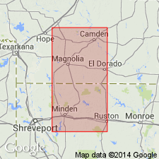
Restricted to the nearshore facies of the Upper Jurassic Schuler Formation of the Cotton Valley Group of Swain (1944) in AR and northern LA. Composed of pastel, varicolored shale and sandstone. Cross sections. Equivalent to the Hico Shale and Knowles Limestone (both new) basinward. Extends in southern AR almost to the AR-LA border in the Arkla basin. Overlies Shongaloo Member ("restricted") of Schuler. Underlies Hosston Formation. Is equivalent to parts of the Hico Shale and Terryville Sandstone (both newly named) of the Cotton Valley downdip in LA.
Source: GNU records (USGS DDS-6; Denver GNULEX).
For more information, please contact Nancy Stamm, Geologic Names Committee Secretary.
Asterisk (*) indicates published by U.S. Geological Survey authors.
"No current usage" (†) implies that a name has been abandoned or has fallen into disuse. Former usage and, if known, replacement name given in parentheses ( ).
Slash (/) indicates name conflicts with nomenclatural guidelines (CSN, 1933; ACSN, 1961, 1970; NACSN, 1983, 2005, 2021). May be explained within brackets ([ ]).