The National Geologic Map Database is migrating to a new infrastructure. We apologize for any service disruptions during this process.
|
|---|


- Usage in publication:
-
- Doneley limestone member
- Modifications:
-
- Original reference
- Dominant lithology:
-
- Limestone
- AAPG geologic province:
-
- Chautauqua platform
Summary:
Pg. 192, 193 (table 1); C.C. Branson, 1955, IN E.W. Reed, S.L. Schoff, and C.C. Branson, Oklahoma Geol. Survey Bull., no. 72, p. 67-68. Doneley limestone member of Savanna formation. Defined as uppermost of three persistent "brown limes" of Savanna formation. At type section, calcareous clay ironstone 3 inches thick, lying 8 inches above a thin coal and its underclay. Lies 70 feet below base of Bluejacket sandstone; overlies Rowe coal, which is above Sam Creek limestone. Name credited to L. P. Chrisman (unpub. thesis). Age is Middle Pennsylvanian (Des Moines). Present in northeastern Oklahoma and [?]southeastern Kansas.
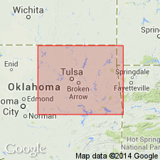
Type section: 1 mi north of school building in NW/4 sec. 16, T. 26 N., R. 20 E., Craig Co., OK, in south bank of creek which crosses north-south section line road. Exposure is about 100 feet east of road. Named from Doneley School, which is shown on USGS topographic map of Vinita quadrangle in NW/4 sec. 27, T. 26 N., R. 20 E., [Craig Co., OK]. This school has been replaced by Pleasant Hill School which is at same location.
[Doneley limestone member not included (or mentioned) in Kansas Geol. Survey classification (Zeller, D.E., ed., 1968, Kansas Geol. Survey Bull., no. 189). GNU records (USGS DDS-6) do not indicate this unit is (was) recognized in KS.]
Source: US geologic names lexicon (USGS Bull. 1200, p. 1137).
For more information, please contact Nancy Stamm, Geologic Names Committee Secretary.
Asterisk (*) indicates published by U.S. Geological Survey authors.
"No current usage" (†) implies that a name has been abandoned or has fallen into disuse. Former usage and, if known, replacement name given in parentheses ( ).
Slash (/) indicates name conflicts with nomenclatural guidelines (CSN, 1933; ACSN, 1961, 1970; NACSN, 1983, 2005, 2021). May be explained within brackets ([ ]).