- Usage in publication:
-
- Doggett Gap Protomylonitic Granitoid Gneiss
- Modifications:
-
- Named
- Dominant lithology:
-
- Gneiss
- AAPG geologic province:
-
- Piedmont-Blue Ridge province
Summary:
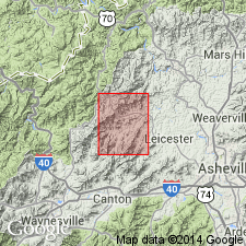
Doggett Gap Protomylonitic Granitoid Gneiss is here defined and formally named in the central Blue Ridge of NC. It is one of five map units composing the Middle Proterozoic basement sequence that underlies 60% of the study area. Unit forms 2 narrow bands in the northwest quarter of the Sandymush quad, the largest of which is 5 mi long and 1 mi wide. Outcrops are dominated by the very coarse grained protomylonite that characterizes the Doggett Gap. Described as a 5,000 ft-thick sequence of mylonitized granitic rocks interlayered with biotite granitic gneiss, biotite tonalite gneiss, and amphibolite. Protomylonitic layers are megacrystic and vary in color from light gray to very pale orange. They are medium to very thick, range from poorly to well-foliated, and compose approximately 70% of the rock. Keith (1904) mapped coarse-grained granitic rocks in this region as part of his Max Patch Granite, but subsequent workers have limited the use of that name to the type area. The Doggett Gap may be equivalent, however, to the Indian Grave metagranite of Brewer (1986: U. of TN, M.S. thesis). Age is interpreted as latest Middle Proterozoic, the protolith of the Doggett Gap having intruded the older Spring Creek Granitoid Gneiss and the Sandymush Felsic Gneiss (new names). Middle to Late Proterozoic mylonitic deformation supports this age assignment.
Source: GNU records (USGS DDS-6; Reston GNULEX).
For more information, please contact Nancy Stamm, Geologic Names Committee Secretary.
Asterisk (*) indicates published by U.S. Geological Survey authors.
"No current usage" (†) implies that a name has been abandoned or has fallen into disuse. Former usage and, if known, replacement name given in parentheses ( ).
Slash (/) indicates name conflicts with nomenclatural guidelines (CSN, 1933; ACSN, 1961, 1970; NACSN, 1983, 2005, 2021). May be explained within brackets ([ ]).

