The National Geologic Map Database is migrating to a new infrastructure. We apologize for any service disruptions during this process.
|
|---|


- Usage in publication:
-
- Dodson member
- Modifications:
-
- Original reference
- Dominant lithology:
-
- Sand
- AAPG geologic province:
-
- Arkla basin
Summary:
Pg. 87-91, 92. pl. 3. Dodson member of Cook Mountain formation. Term proposed for the basal fossiliferous glauconitic, clayey sands which underlie the Milams member and overlie the Sparta sands. As defined, the Dodson includes the lower 17 feet of the Milams member as defined by Ellisor (1929). Thickness 4 to 25 feet. Age is Eocene (Claiborne).
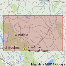
Named from town of Dodson in sec. 27, T. 13 N., R. 3 W., north-central Winn Parish, central LA. This is nearest geographical name to any of the typical localities described.
Source: US geologic names lexicon (USGS Bull. 1200, p. 1129).
For more information, please contact Nancy Stamm, Geologic Names Committee Secretary.
Asterisk (*) indicates published by U.S. Geological Survey authors.
"No current usage" (†) implies that a name has been abandoned or has fallen into disuse. Former usage and, if known, replacement name given in parentheses ( ).
Slash (/) indicates name conflicts with nomenclatural guidelines (CSN, 1933; ACSN, 1961, 1970; NACSN, 1983, 2005, 2021). May be explained within brackets ([ ]).