

- Usage in publication:
-
- Dobys Bluff Tongue
- Modifications:
-
- Original reference
- Dominant lithology:
-
- Sand
- Clay
- AAPG geologic province:
-
- Mid-Gulf Coast basin
Summary:
Pg. 33-41. Dobys Bluff Tongue of Kosciusko Formation. Gray, reddish-brown weathering, lenticular sand and carbonaceous clay, weathers reddish brown. Thickness 6 m (about 20 feet). Overlies nonfossiliferous sand of Kosciusko Formation; unconformably underlies Archusa Marl Member of Cook Mountain Formation. Equivalent to Stone City Beds of the Sparta Formation in Texas. Interpreted as marine destructional shelf facies of the Kosciusko delta system. Fossils. Age is Eocene.
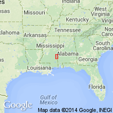
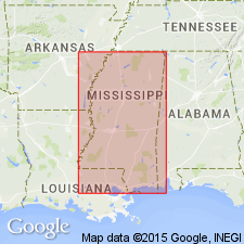
Type section: exposure at Dobys Bluff on east side of Chickasawhay River south of Quitman, in NW/4 SW/4 NW/4 sec. 18, T. 2 N., R. 16 E., Clarke Co., east-central MS.
Source: US geologic names lexicon (USGS Bull. 1564, p. 47); GNU records (USGS DDS-6; Reston GNULEX).
- Usage in publication:
-
- Dobys Bluff Tongue
- Modifications:
-
- Overview
- AAPG geologic province:
-
- Mid-Gulf Coast basin
Summary:
Dobys Bluff Tongue of Kosciusko Formation of Claiborne Group. Underlies Archusa Marl Member, or where Aruchusa is absent, underlies Potterchito Member of Cook Mountain Formation of Claiborne Group. In downdip (south) area, underlies Cook Mountain or CAMERINA limestone, and overlies Cane River Formation of Claiborne. Age is middle Eocene (Lutetian); nannofossil zones NP15 to NP16, planktic foram zones P11 to P12.
Source: Publication.
For more information, please contact Nancy Stamm, Geologic Names Committee Secretary.
Asterisk (*) indicates published by U.S. Geological Survey authors.
"No current usage" (†) implies that a name has been abandoned or has fallen into disuse. Former usage and, if known, replacement name given in parentheses ( ).
Slash (/) indicates name conflicts with nomenclatural guidelines (CSN, 1933; ACSN, 1961, 1970; NACSN, 1983, 2005, 2021). May be explained within brackets ([ ]).